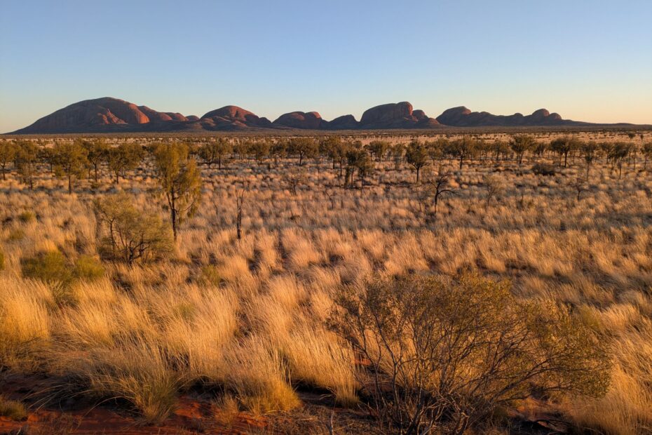
Image: Kata Tjuta at sunrise
20 July 2025
Post 1 of 3
Exploring Kings Canyon, Uluru, Kata Tjuta and Yulara
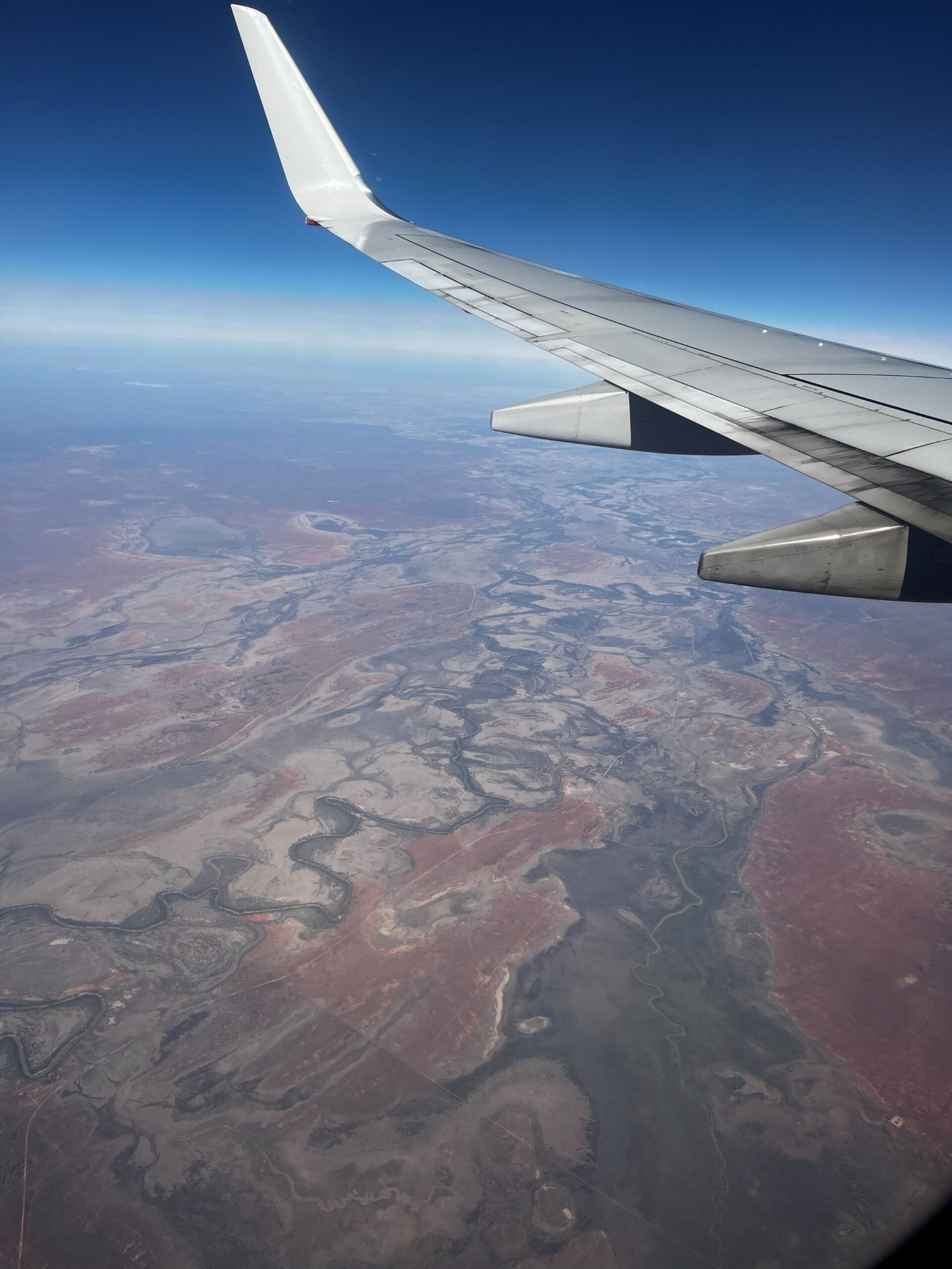
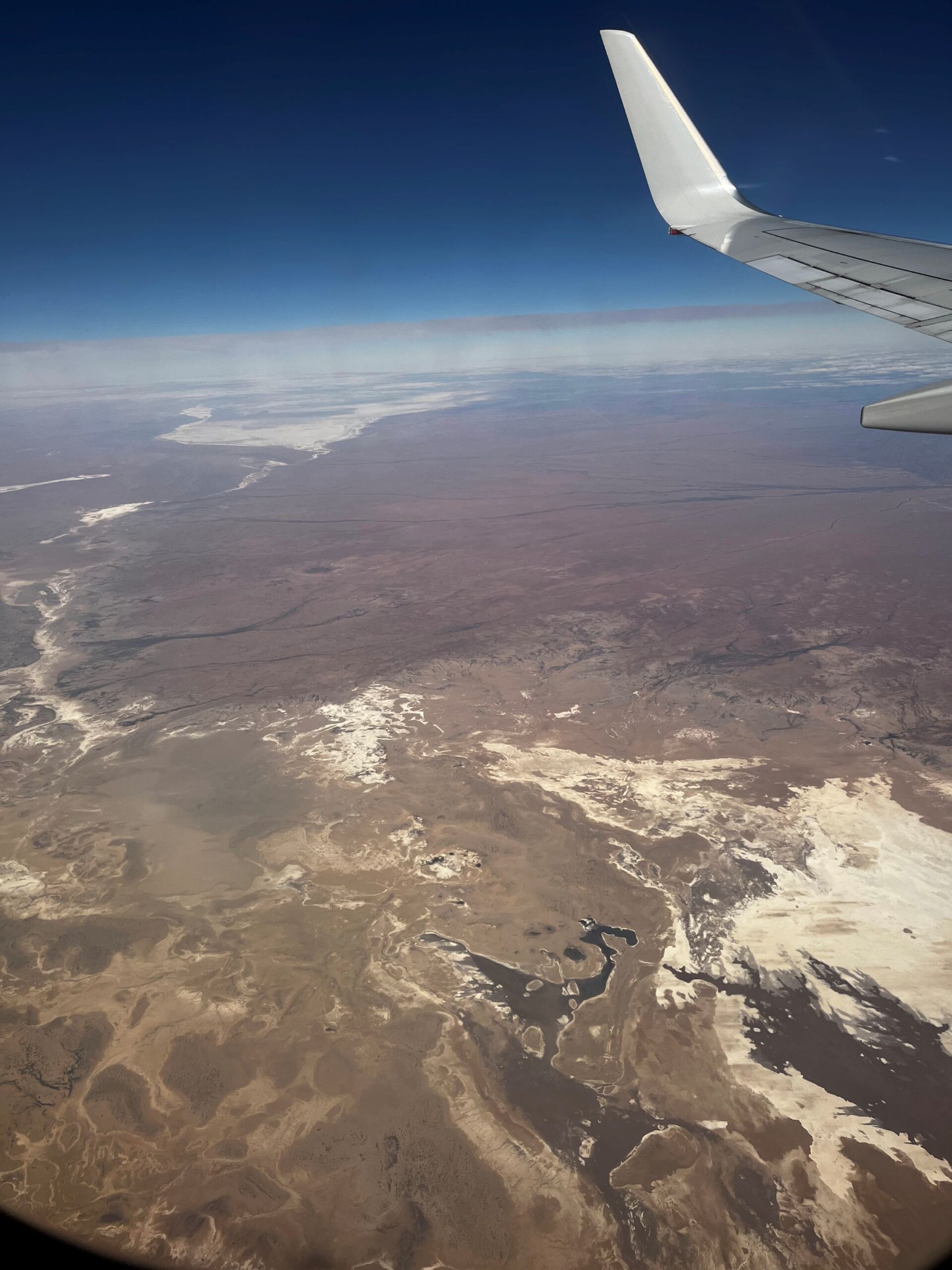
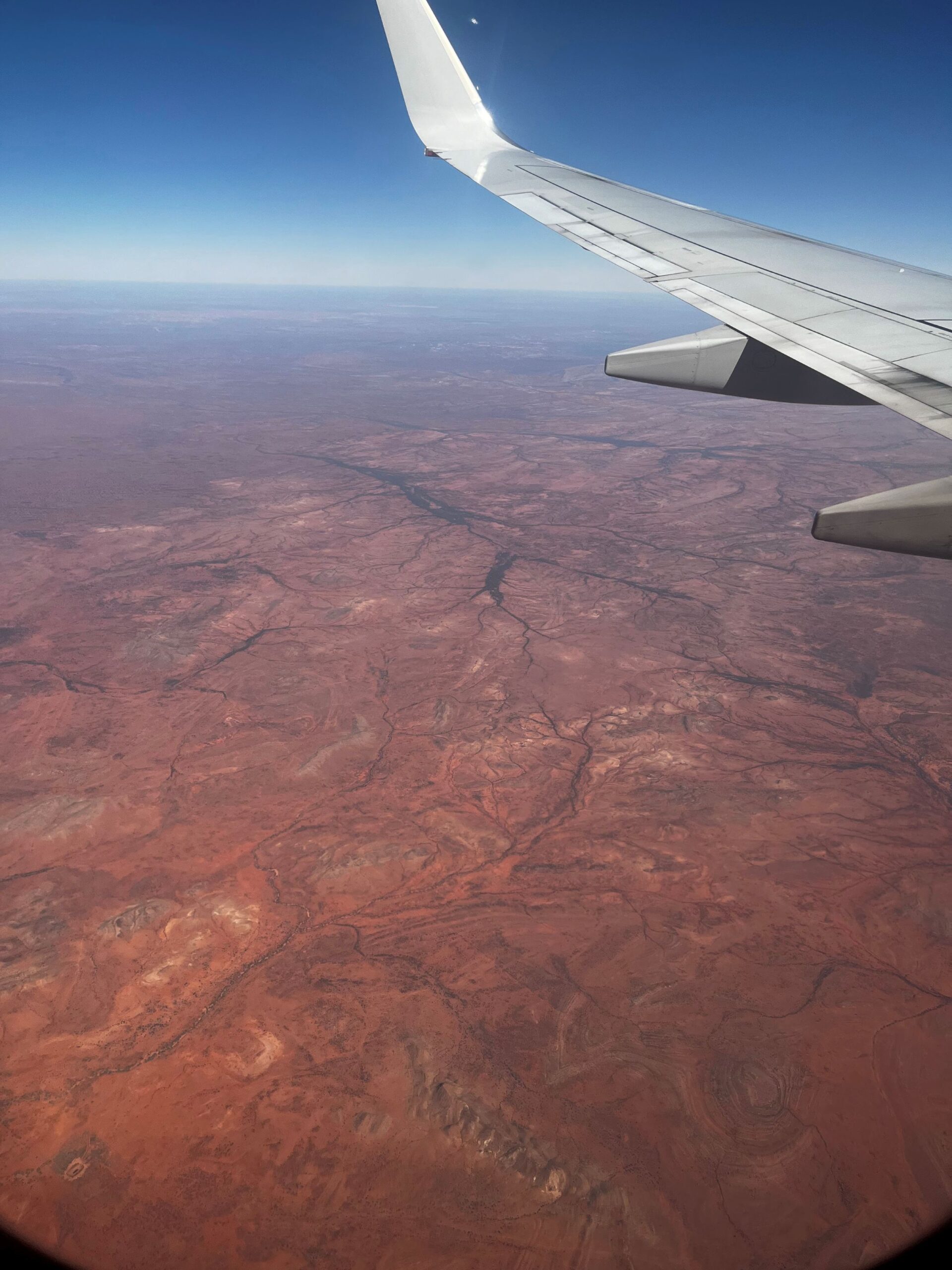
Flying from Sydney to Alice Springs, Emma and I were treated to a view of Lake Eyre filling with water. Em had the window seat so took a photo a minute to make sure we didn’t miss anything. I was sitting next to a man who spent the whole flight coughing and wiping his runny nose on his clothes – it was a good thing Em and I had facemasks to wear. Out the window the colours of the landscape were stunning and the lines of the landscape were mesmerising. As we got closer to Alice the desert changed as the green crept back into the picture.
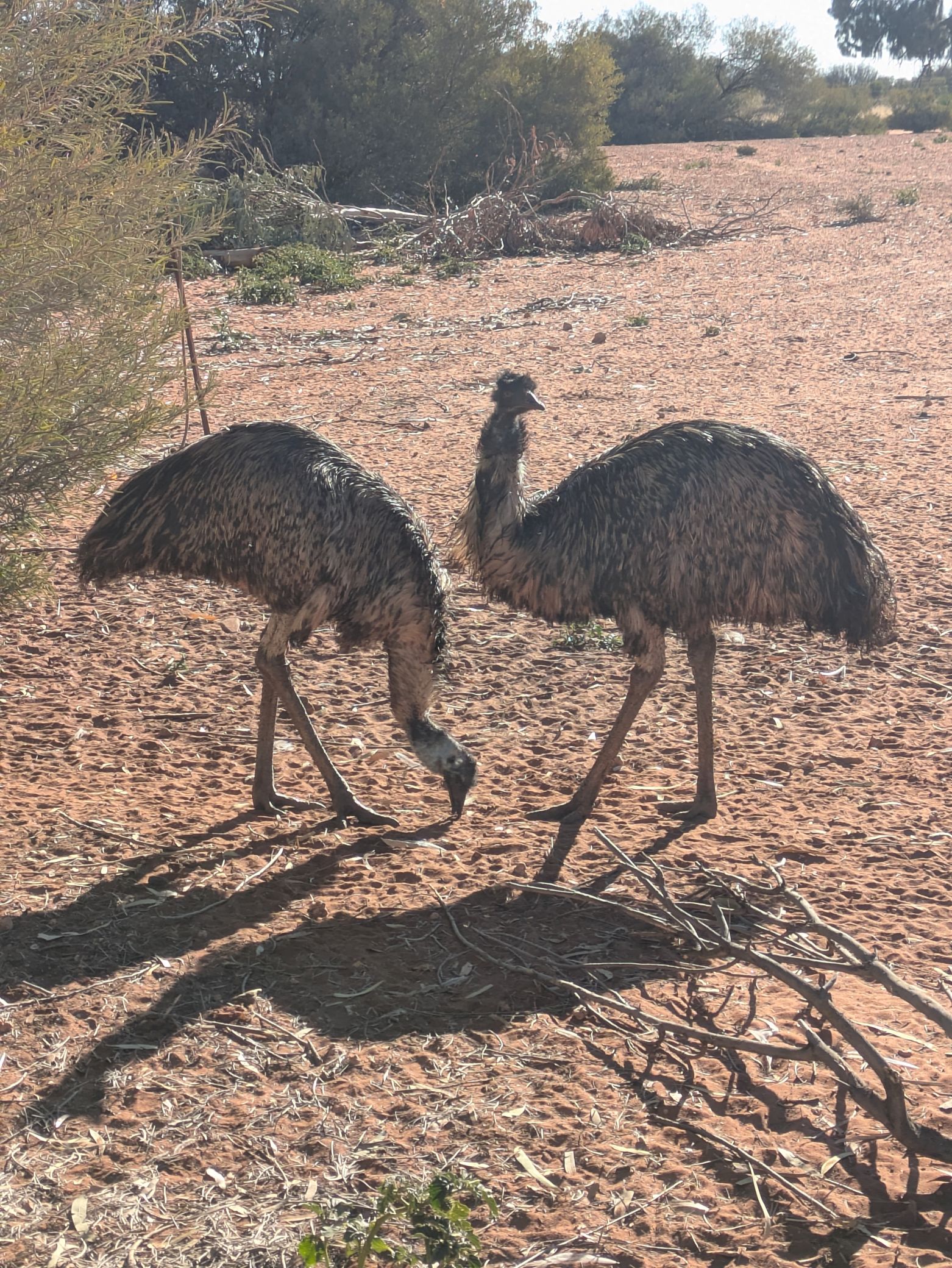
Em and I were on our way to do a 9-day hike along the Larapinta Trail with our delightful friend Nicole, who had flown in the night before from Melbourne. But before the hike, we were going to visit the tourist sites, so we collected our Prado and Nicole, and drove west-ish to Kings Creek Station (3.5hrs, 330km) via the Stuart Highway. We had wanted to take the more scenic route through Hermannsburg but time and daylight was not on our side. We spotted emus, wild camels and brumbies on our drive, and were boggled by the size of the private landholdings we were driving through.
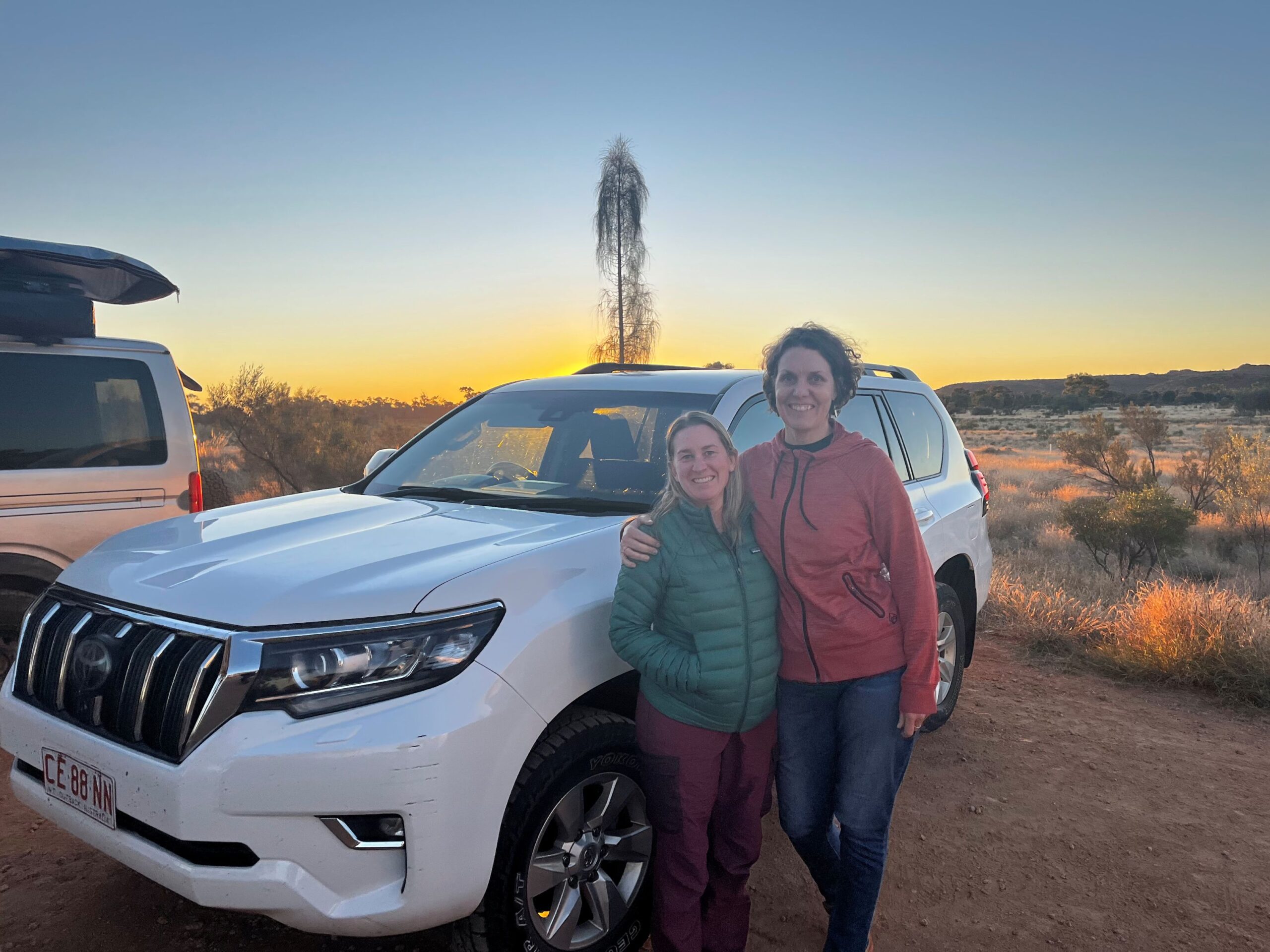
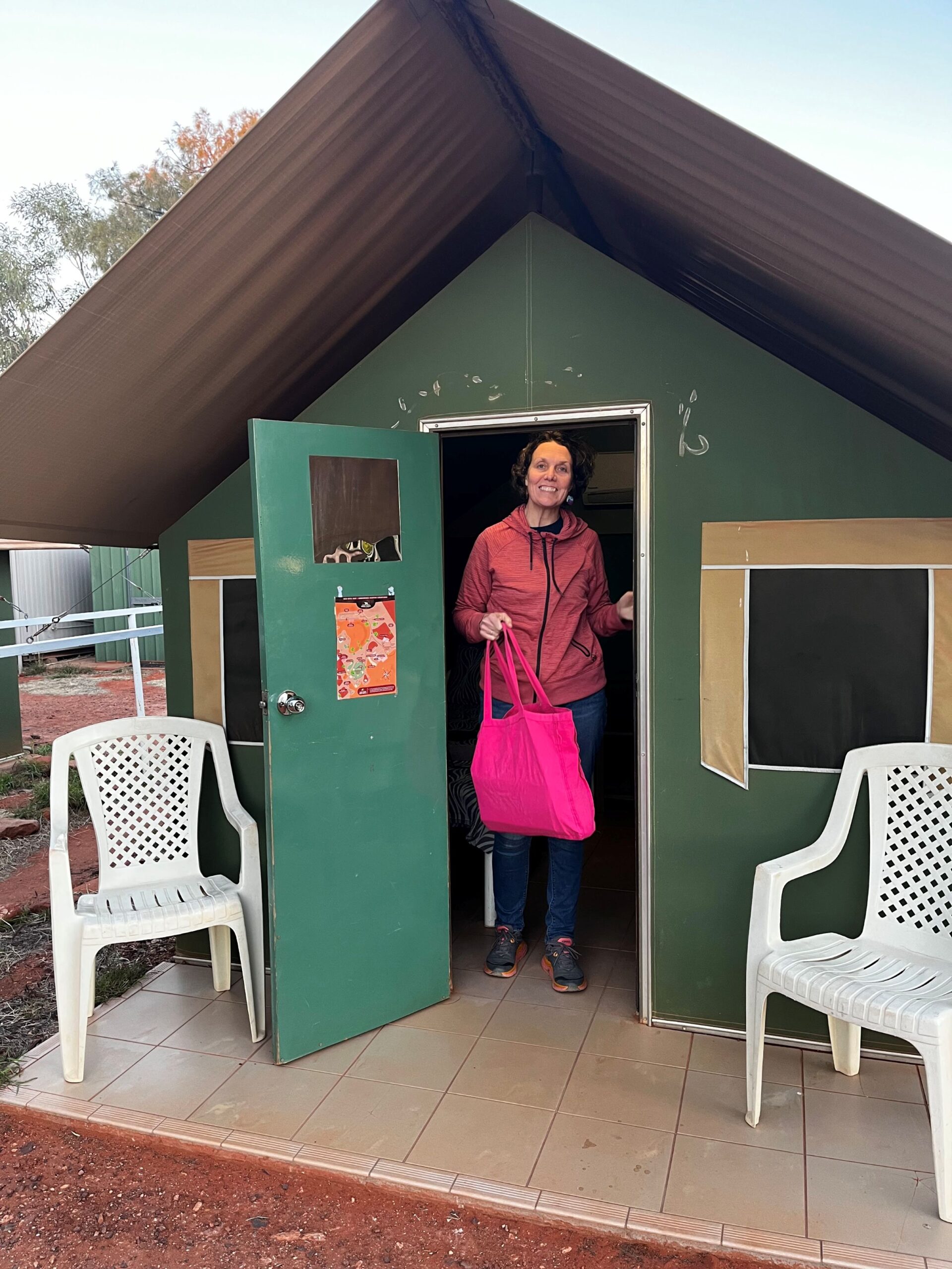
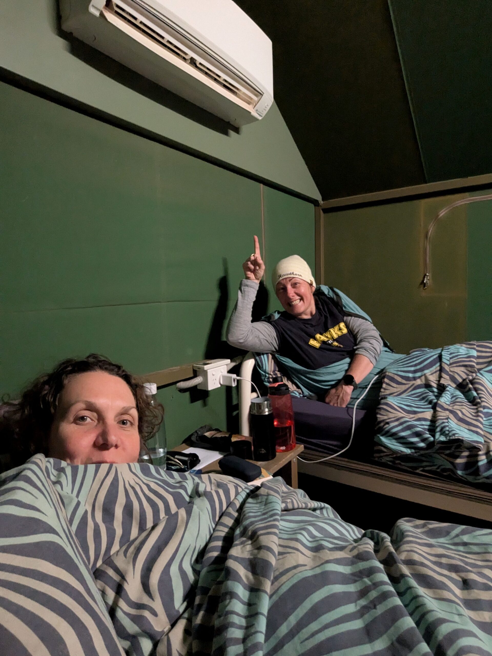
We arrived at Kings Creek Station at 5:58pm just in time to collect the keys to our “tents”, see the sunset and make it to the kitchen for 6:30pm last orders. Phew! I had a caesar salad while the girls shared a camel burger. The tents were pretty comfortable with reasonably stable beds, power outlets and reverse cycle air conditioning cause it got down to 0° overnight.
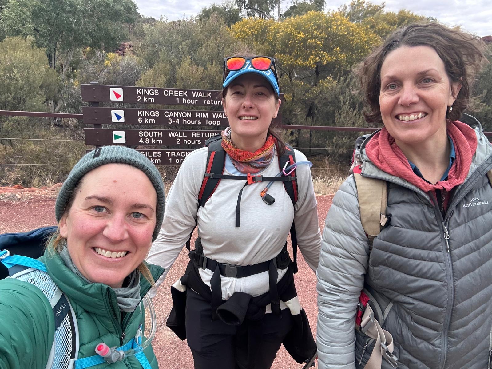
A “bushman’s buffet” brekky was included in our tariff so we were at the mess shed at 6:30am given we had a full itinerary for the day. Turns out tour groups from far and wide time their visits to Kings Canyon to include breakfast at Kings Creek Station so there was a huge influx of hungry (and rude) people which made brekky a somewhat unpleasant experience.
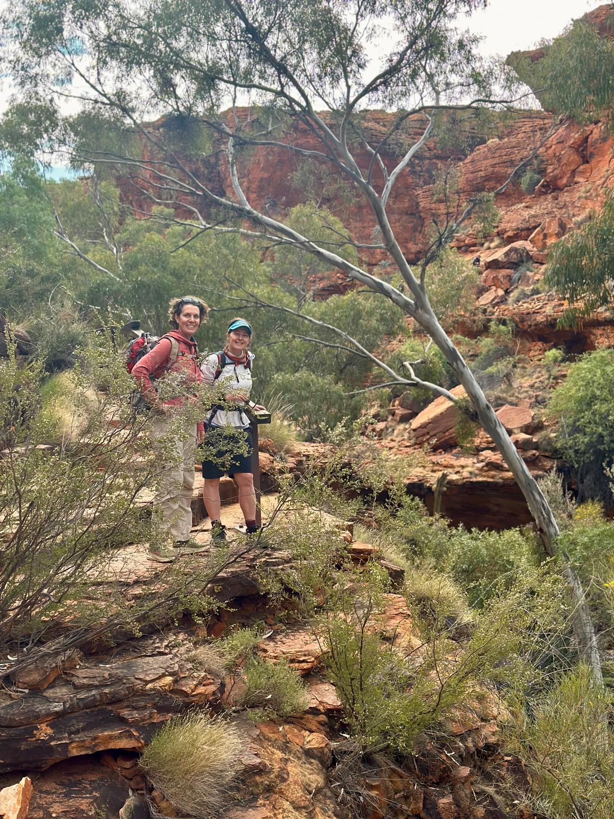
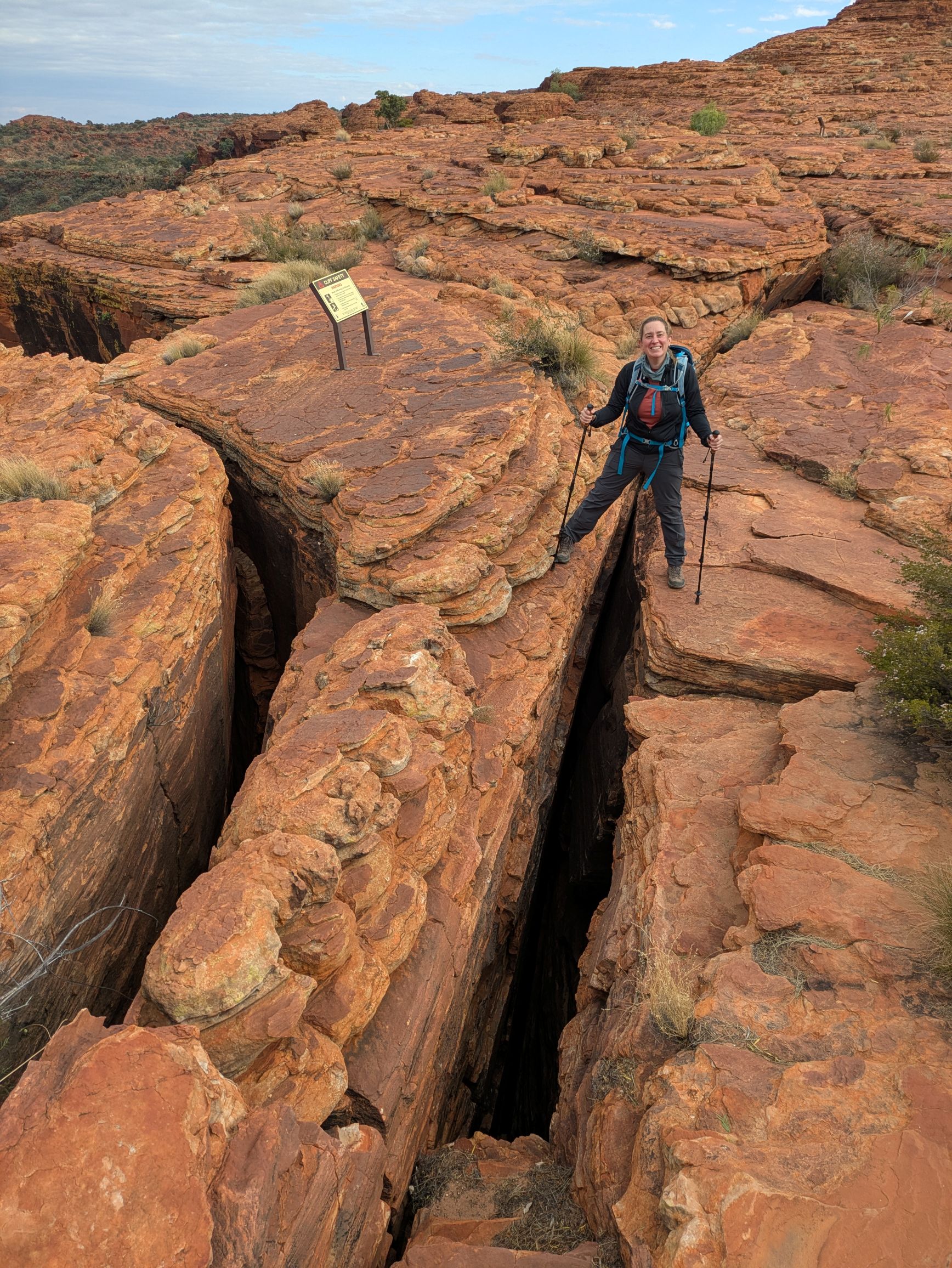
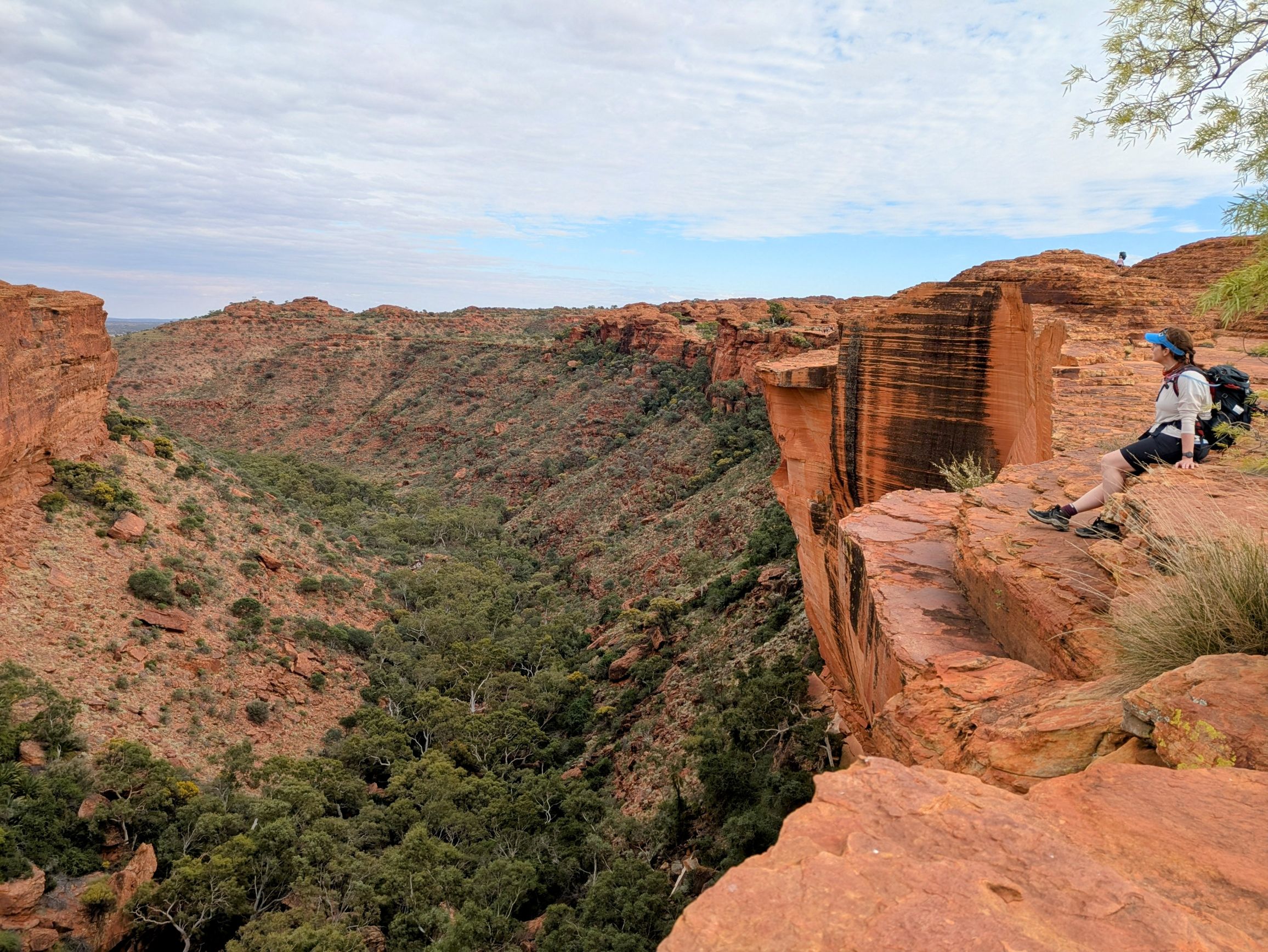
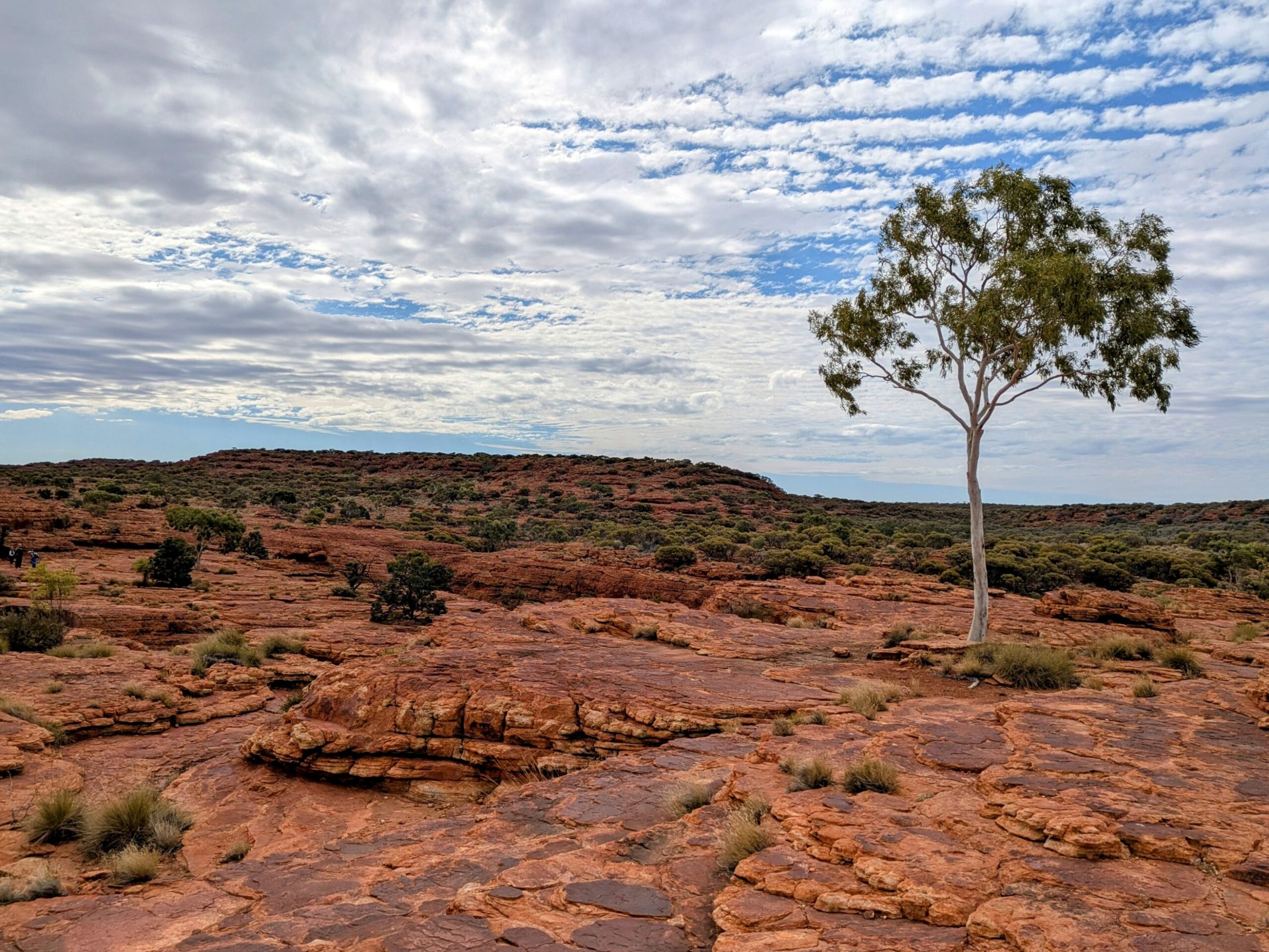
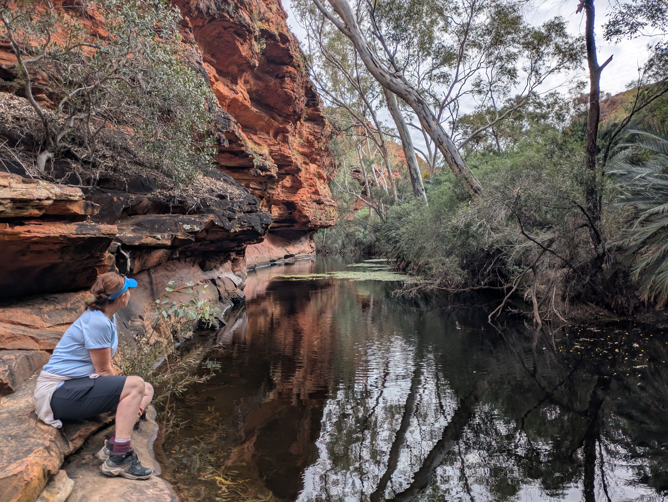
Still, we filled our bellies and were on the road by 7:30am heading to Watarrka National Park to visit Kings Canyon. Situated around Kings Creek, the canyon walls rise up about 100m to form a plateau of rocky domes, rock holes and gorges with a dense palm forest at the base and a permanent waterhole which is sacred to the Luritja Aboriginal people who have lived in the area for over 20,000 years. We were super keen to get into the rhythm of walking on the rocky terrain and test out our gear before we started the Larapinta trek and managed to walk 9km in exploring Kings Canyon – in and out, up and around, and down to the Garden of Eden where we found a lonely Grebe.
After some stretching and de-stinking back at the Prado, we lunched in the car on the drive to Yulara (3.5hrs, 324km), conscious of having enough time to check-in, get our bearings and be in position for sunset watching at Uluru. Driving through the stark yet beautiful landscape, I had lots of memories of my visits to the area 26 and 33 years ago and was surprised that everything mostly looked the same. Really, the only differences along the highway were a few less roadhouses (petrol stations) and some new nice public art installations. Yulara (the township near Uluru) is almost timeless.
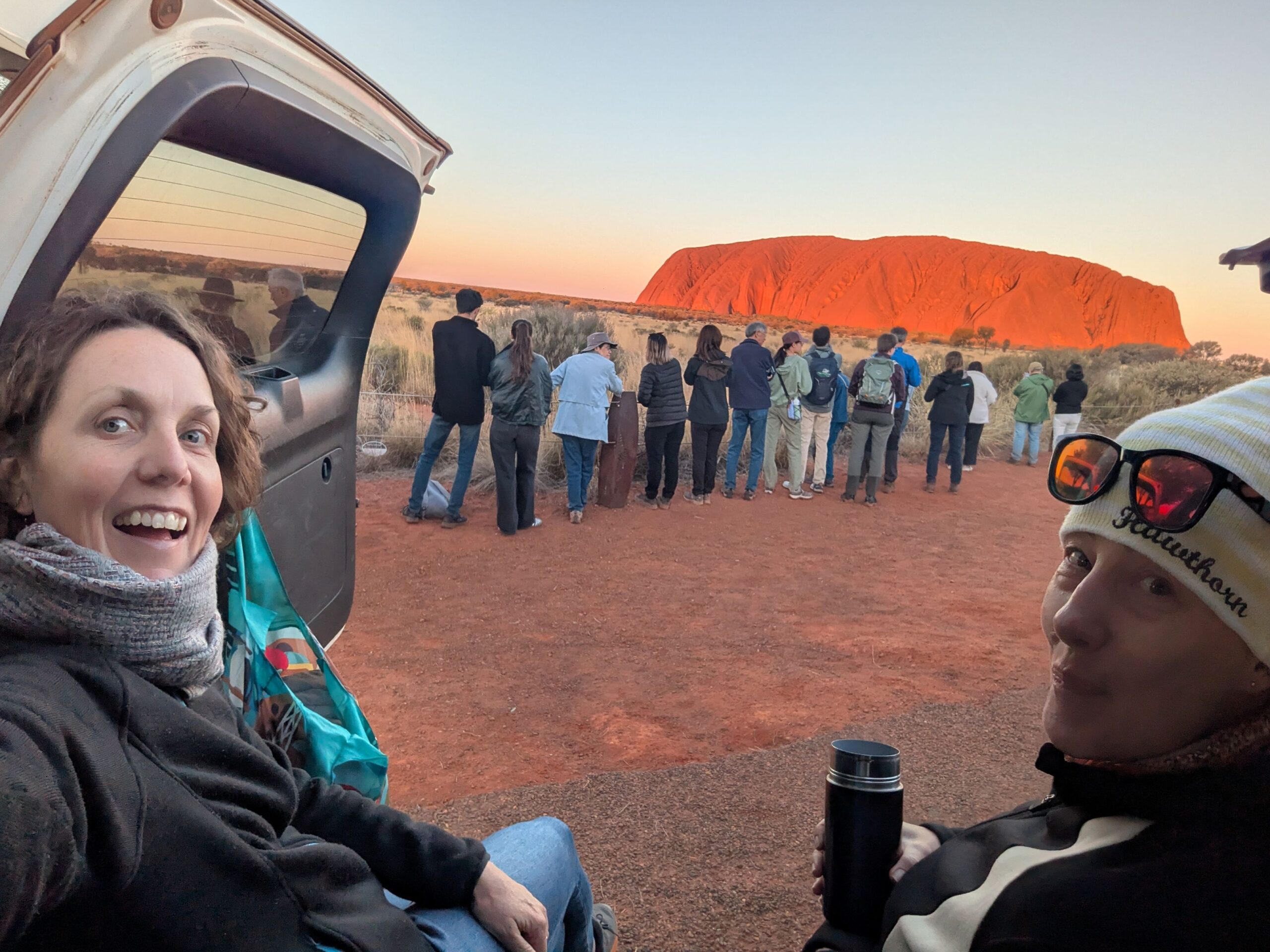
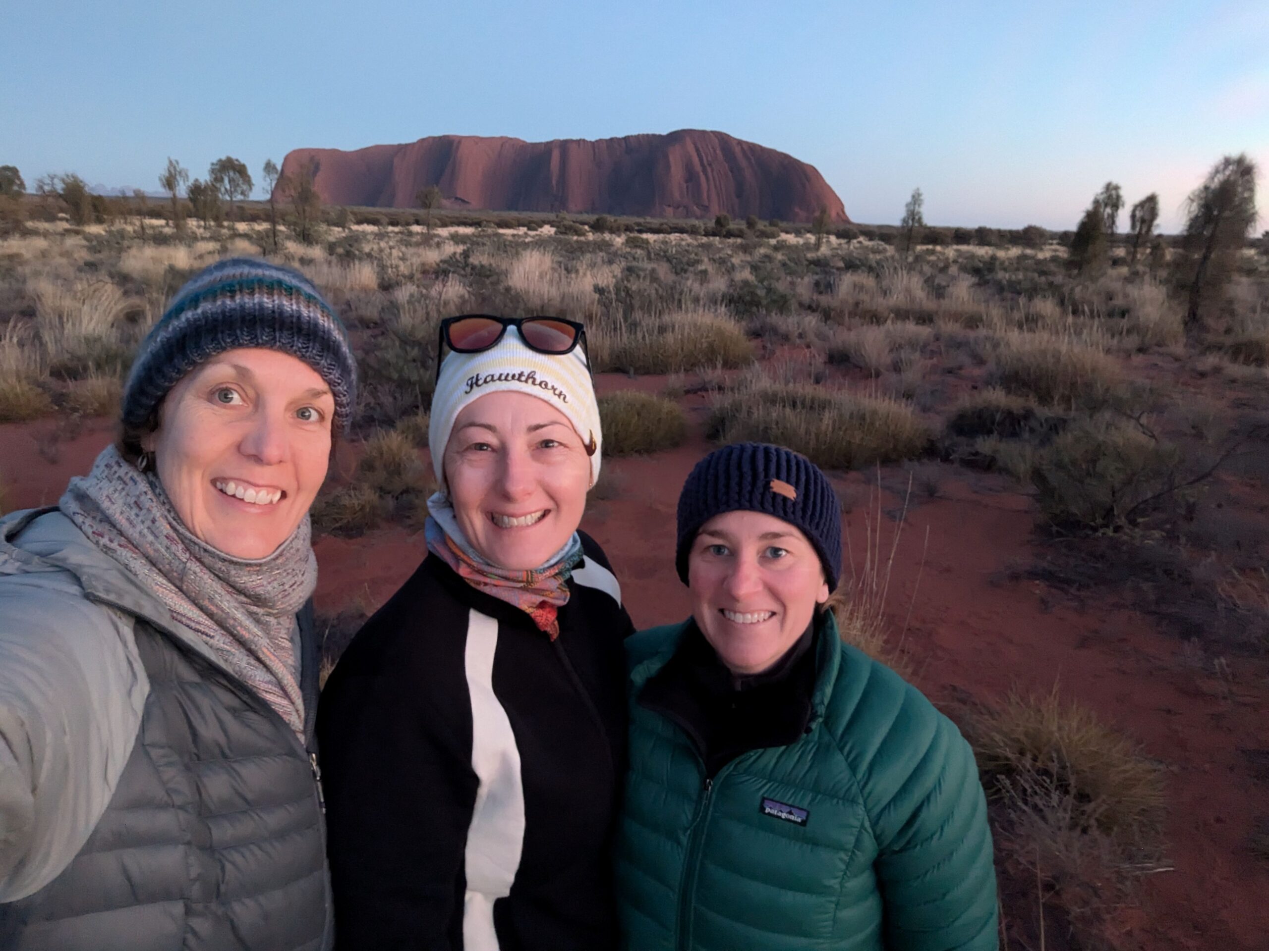
In Yulara, Nic demonstrated her expert negotiation skills in ensuring our hotel room had three beds that we could actually fit in (length wise) before we took our sunset nibbles and gin to line up with the throngs and wait for the magic to happen. Our first sunset experience at Uluru was cloudy but Em captured a fabulous photo with the sunlight highlighting the yellow of the grass in the foreground. Our second sunset experience was more in line with the tourist brochures, with the rock burning reds and oranges as the earth moved away from the point in the sky where the sun is (what’s really happening at sunset).
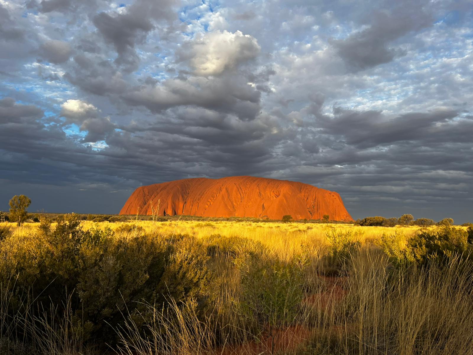
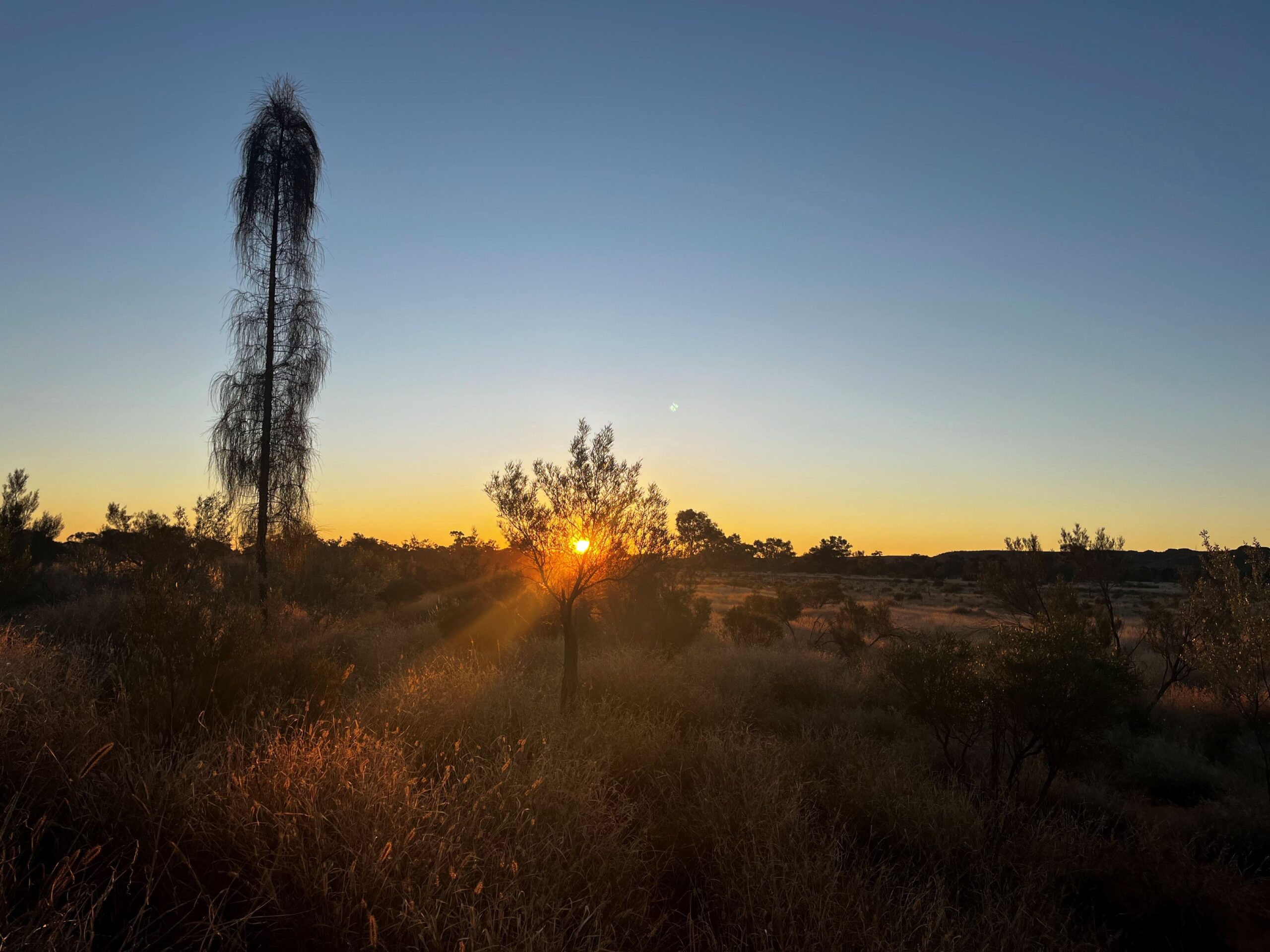
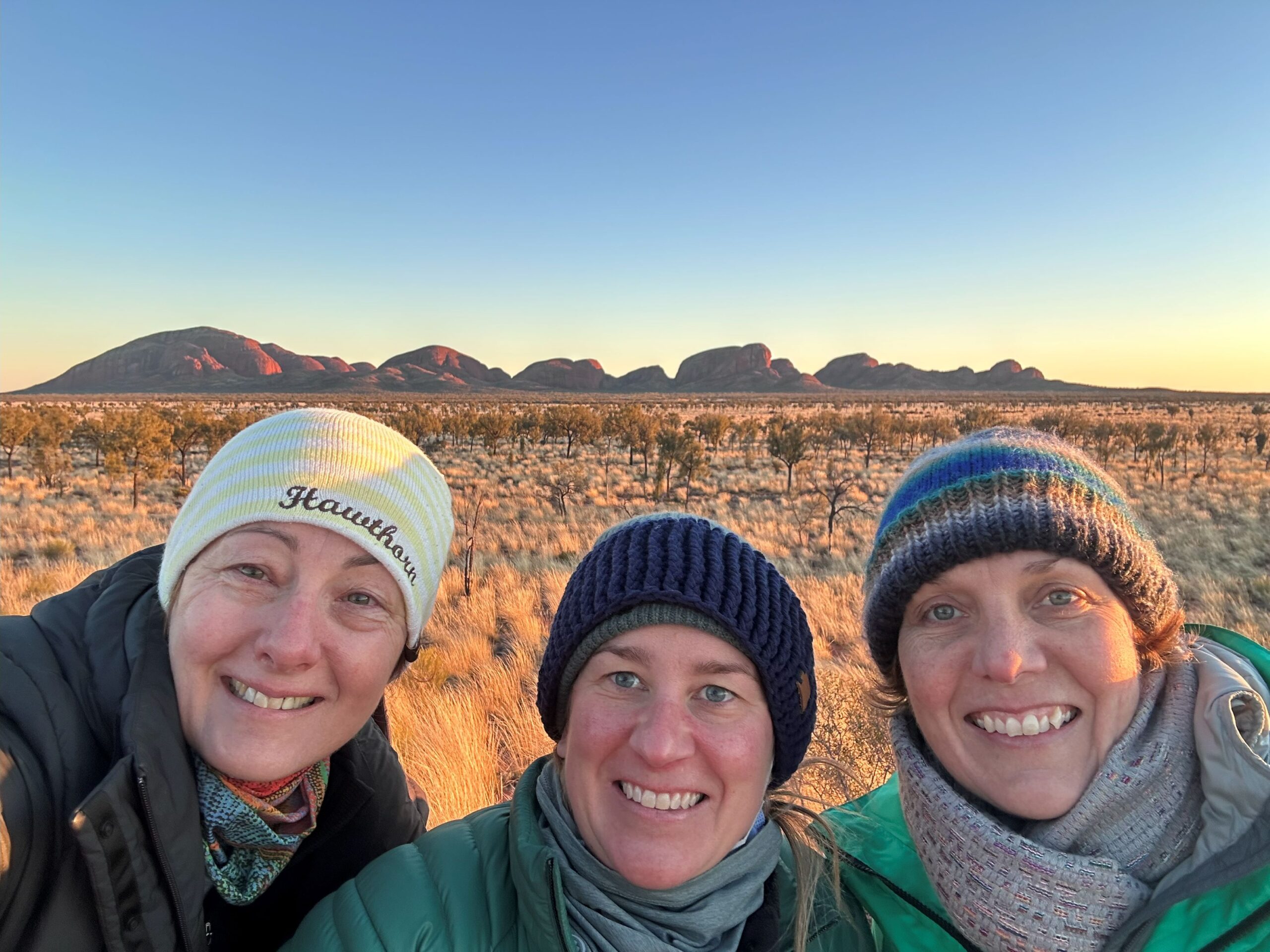
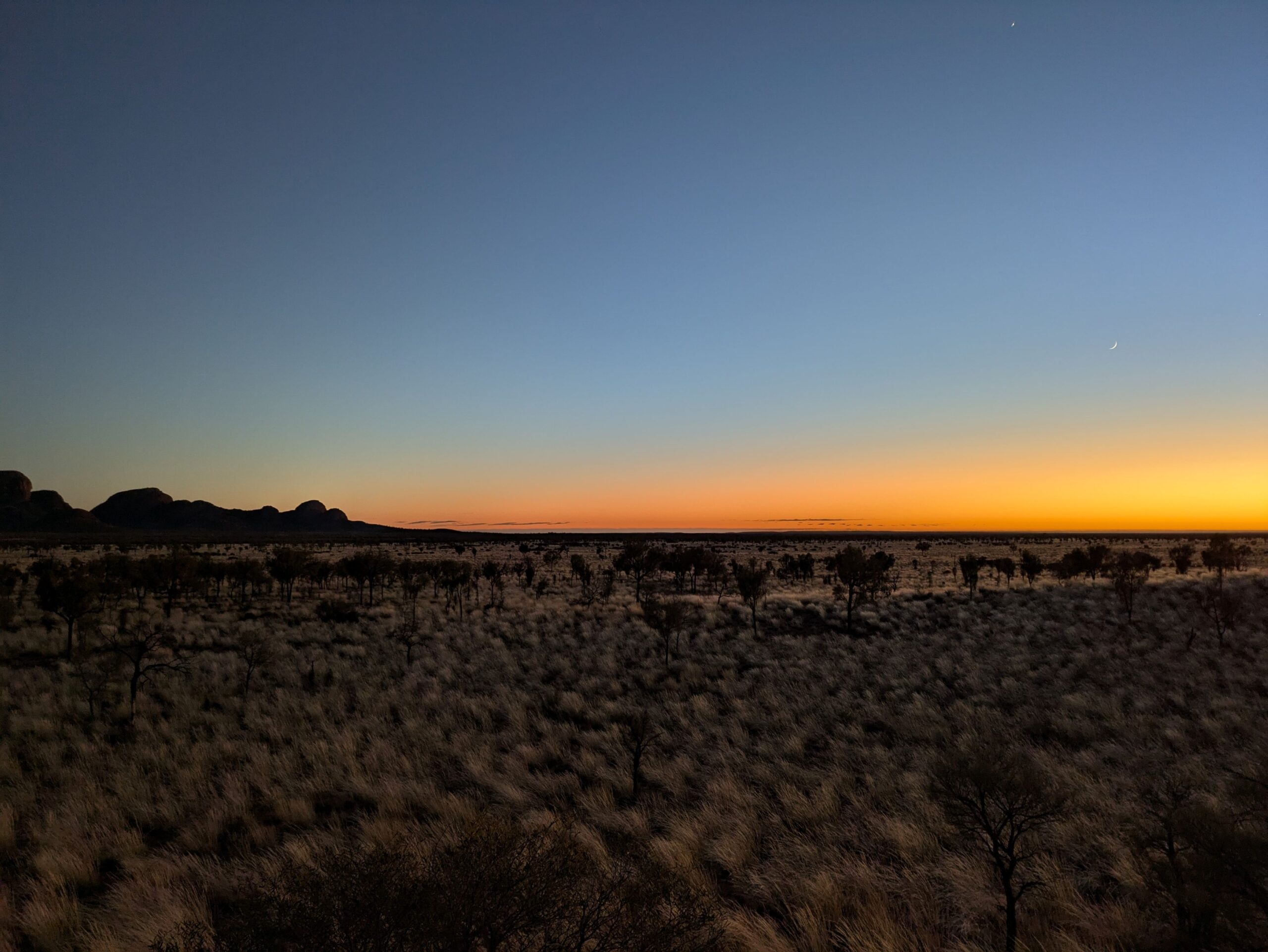
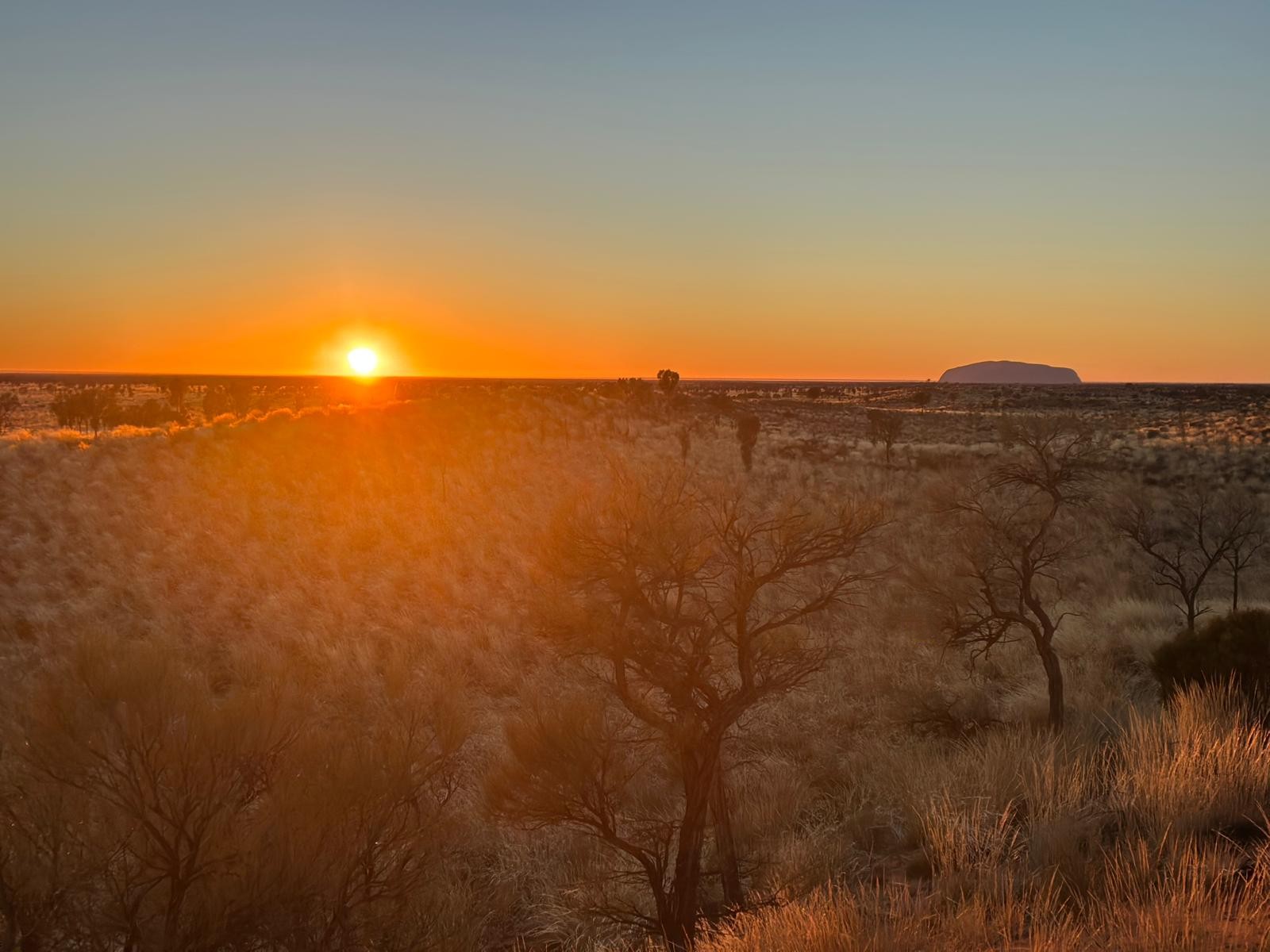
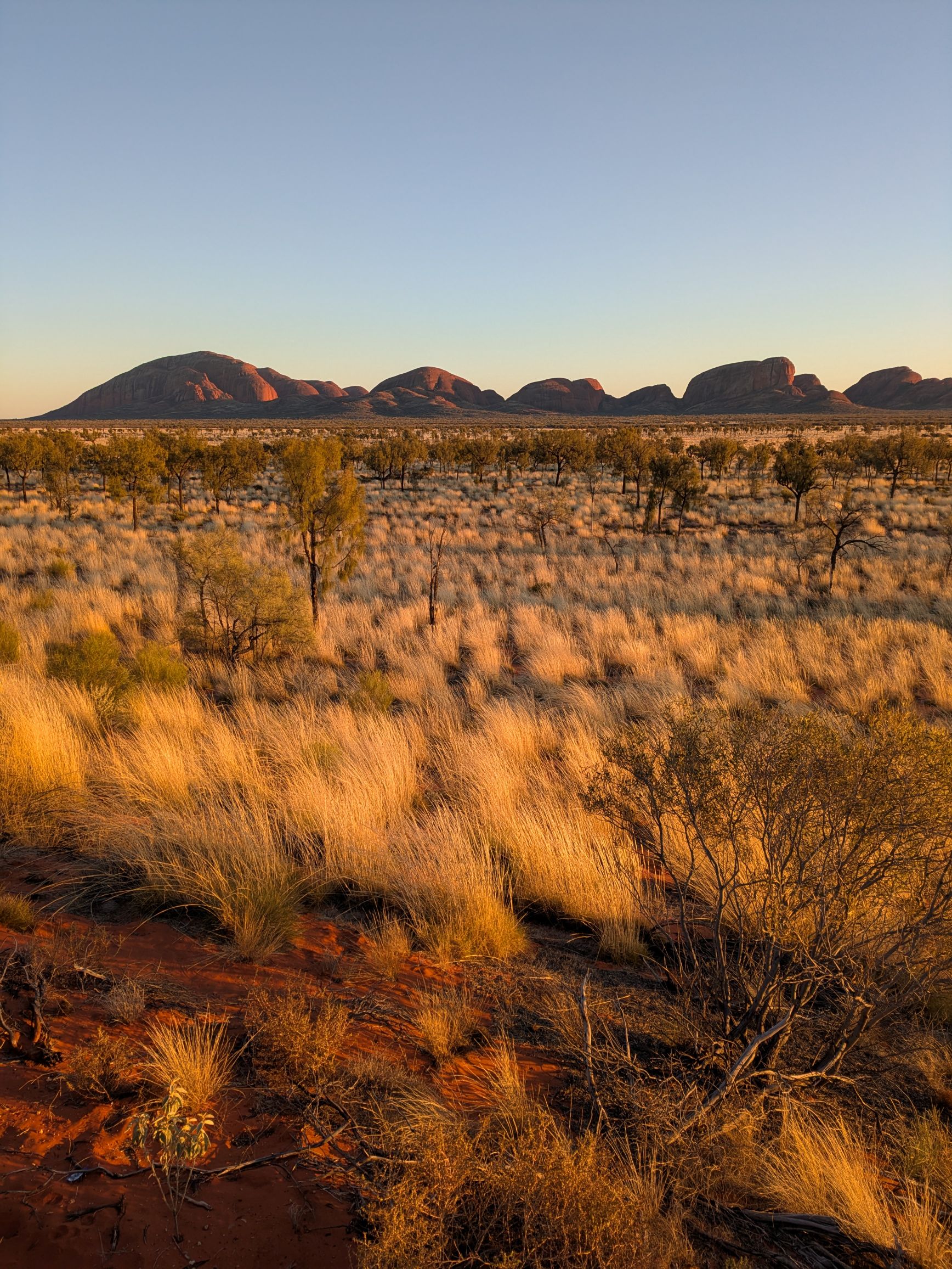
We saw the sunrise at both Uluru and Kata Tjuta during our stay (or to be astronomically correct, we saw the earth move towards the point in the sky where the sun is both days). In summary, it was COLD. At Uluru, the sun was too far north (given it was July) so there wasn’t much colour to the landscape as the day came to be. At Kata Tjuta, the colours were beautiful as daylight creeped up to the horizon and across the desert. We were watching the constellations fade away and the outline of Uluru on the horizon – it was very special. But our toes and noses were frozen. We were dancing on the spot or standing wedged next to each other to keep warm. Funny how the photos don’t show that discomfort at all!!
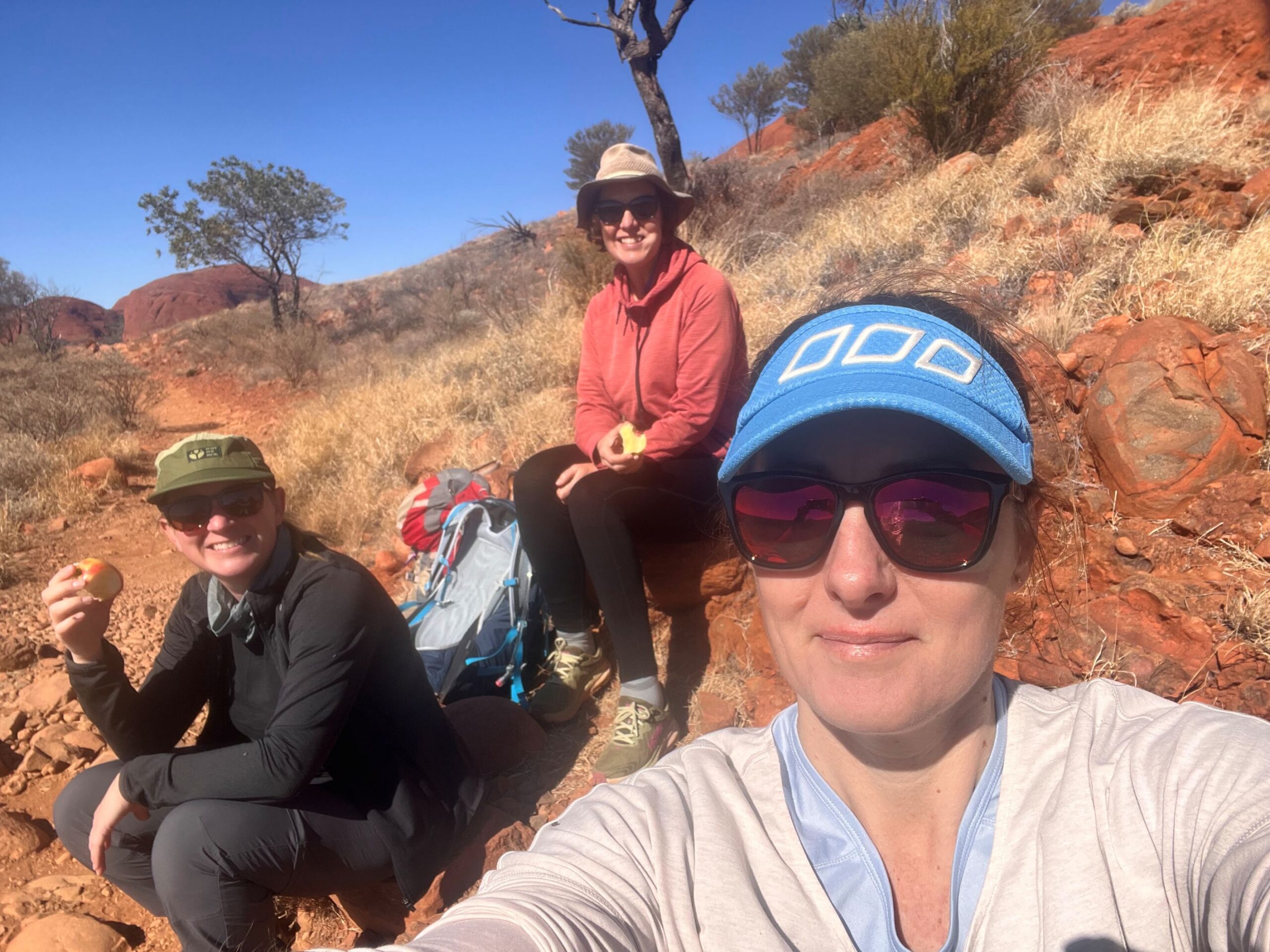
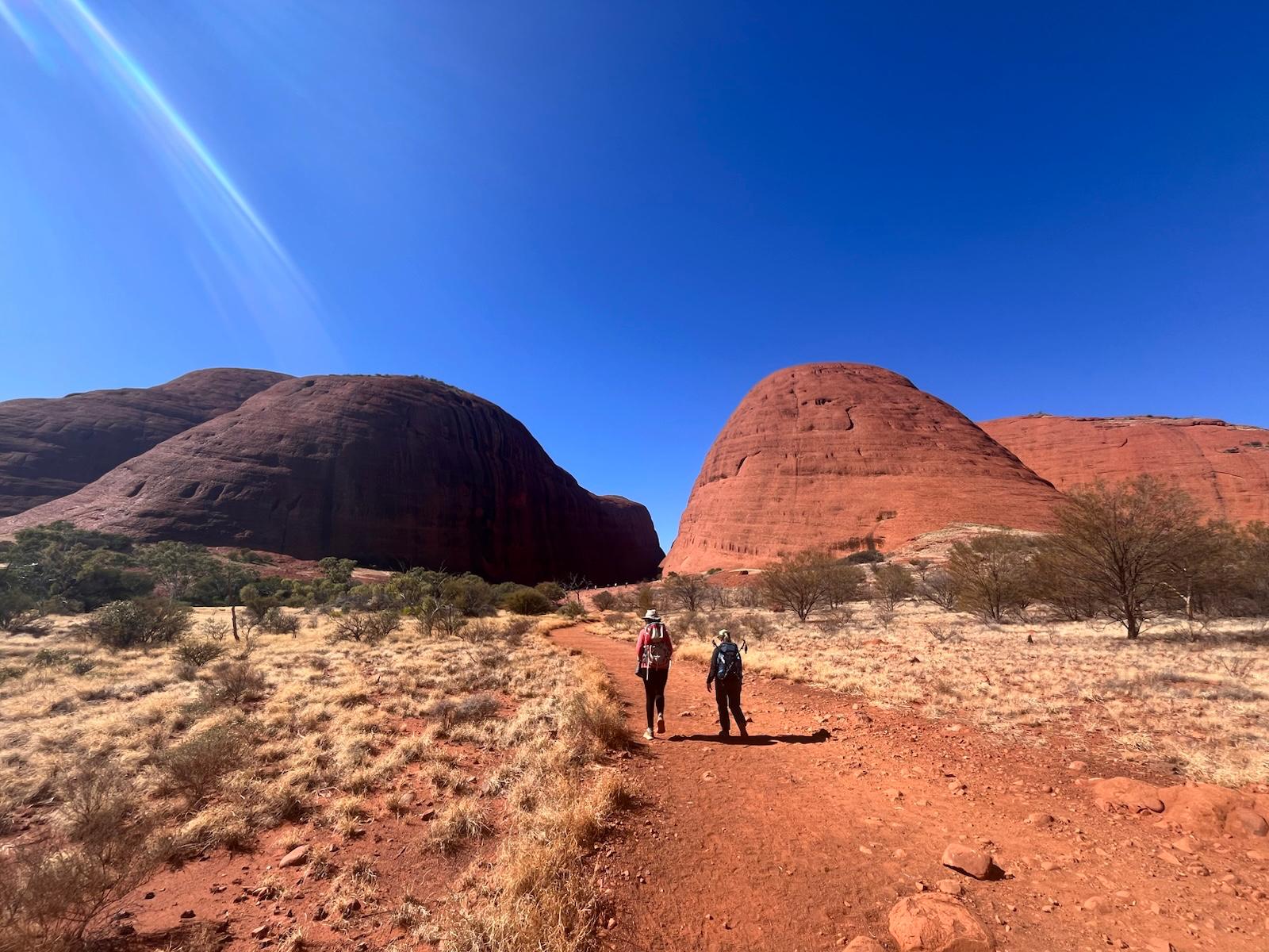
At Kata Tjuta we walked the 7.5km Valley of the Winds. Photos of the rock formations are not permitted given it’s a sacred Aboriginal women’s site so we were respectful and only took a photo of us having a rest break eating apples. The walk is absolutely stunning – the views are amazing and the walk varied and interesting. We thought we saw some rare parrots, and tried to convince another hiker of the fact, but turns out we were wrong and they were standard parrots, but pretty standard parrots! We also explored the tourist infested Walpa Gorge – at the other end of Kata Tjuta – before returning to Yulara for a pizza lunch, a relax, a swim for Nic in the (very cold) pool and back to Uluru for sunset sippers with the crowds.
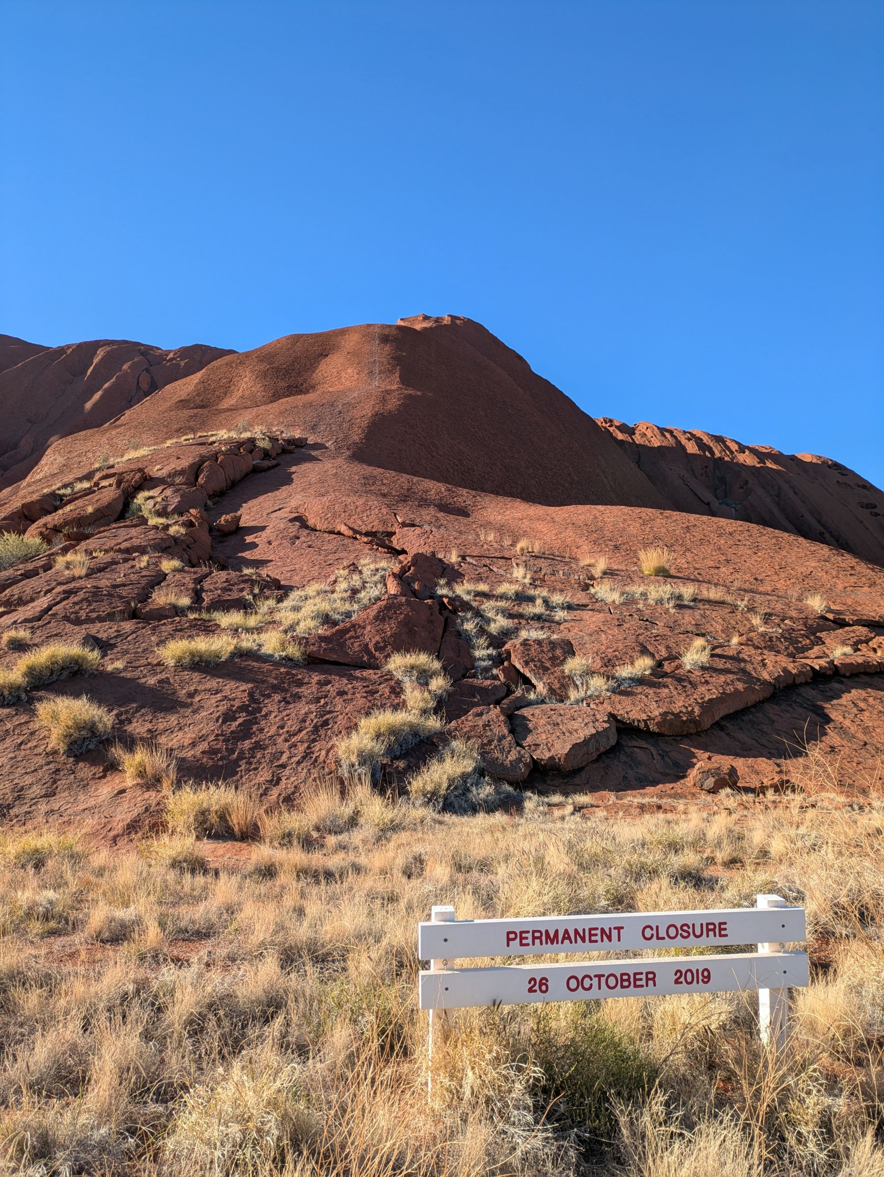
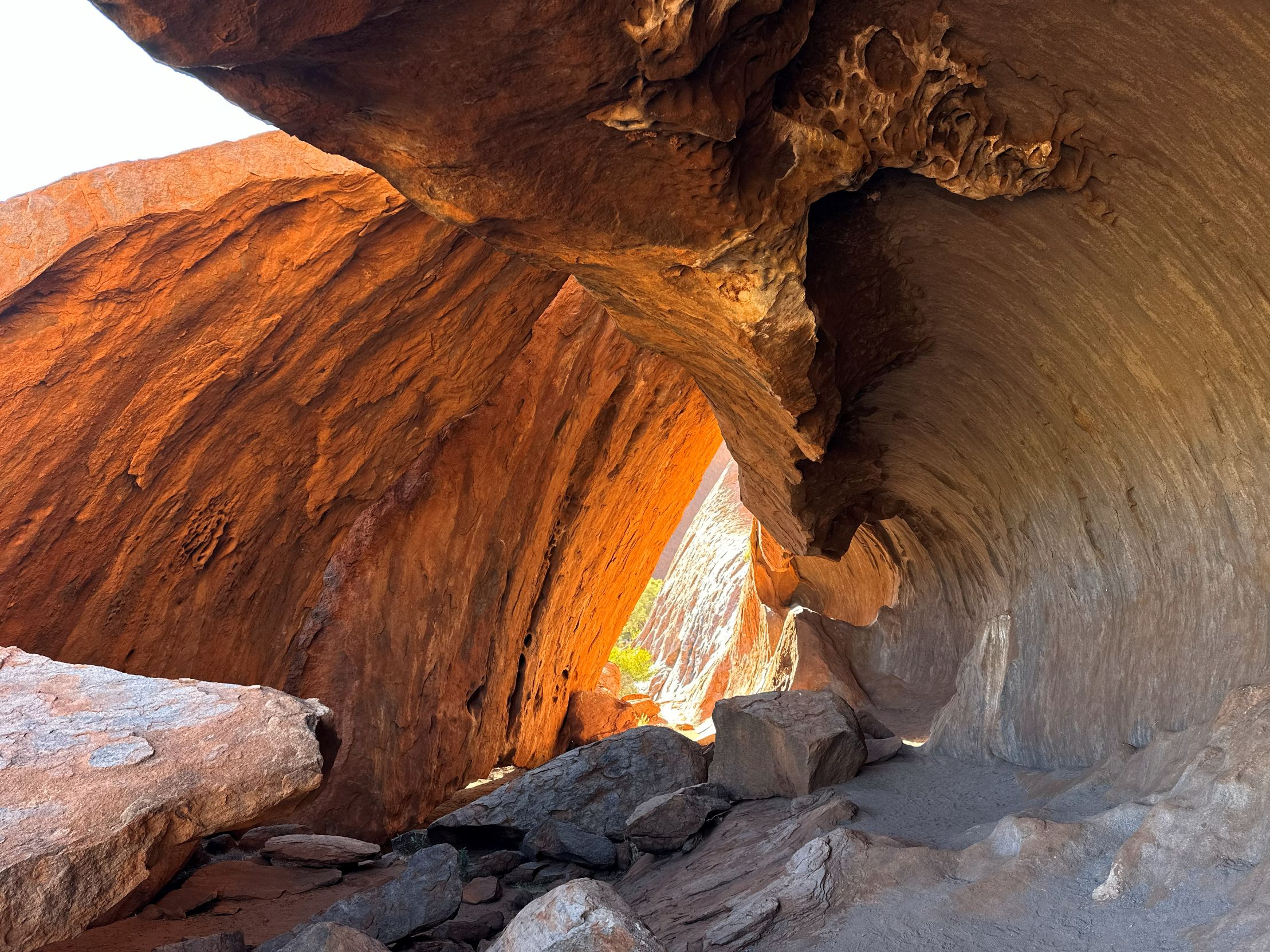
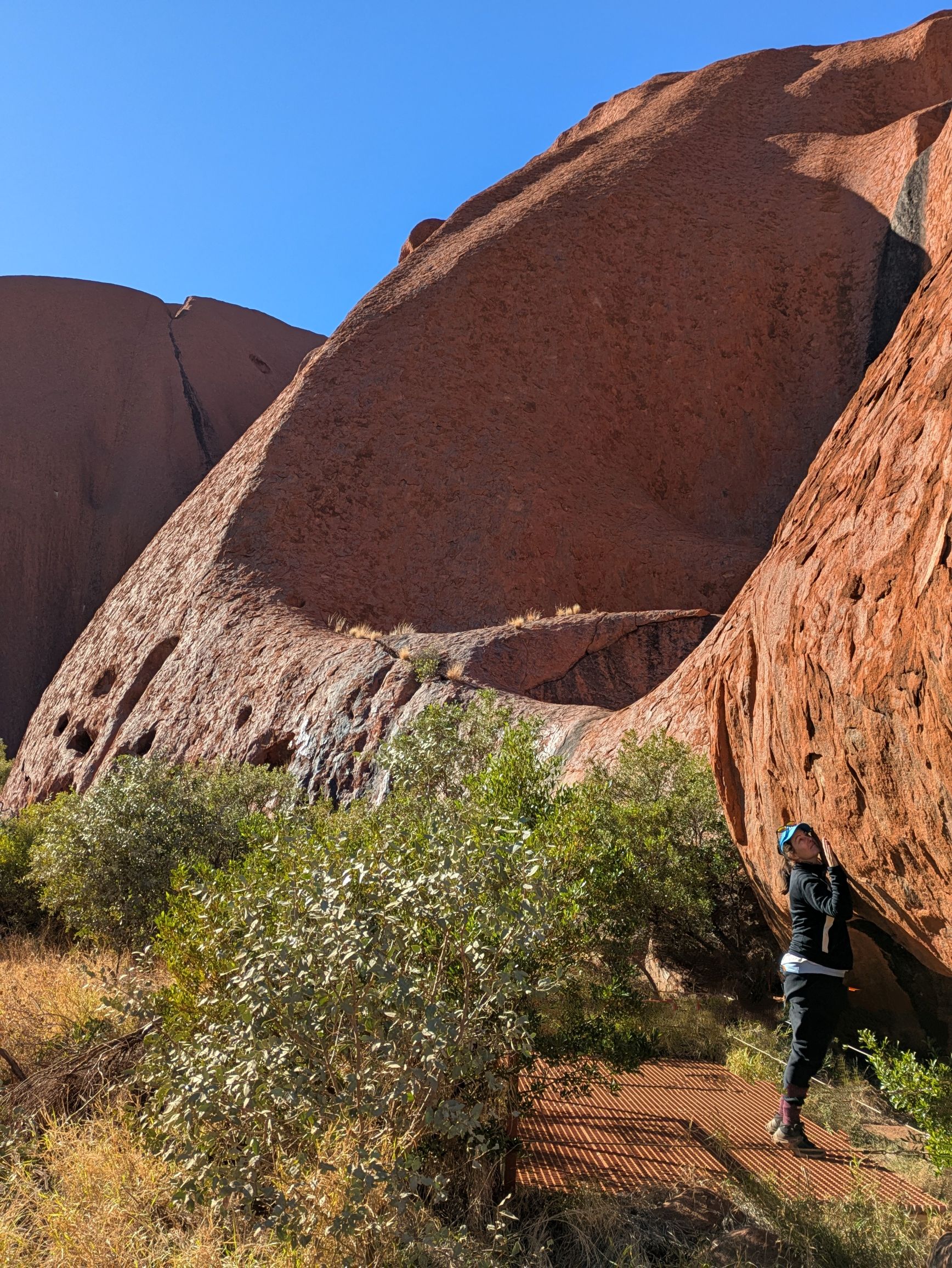
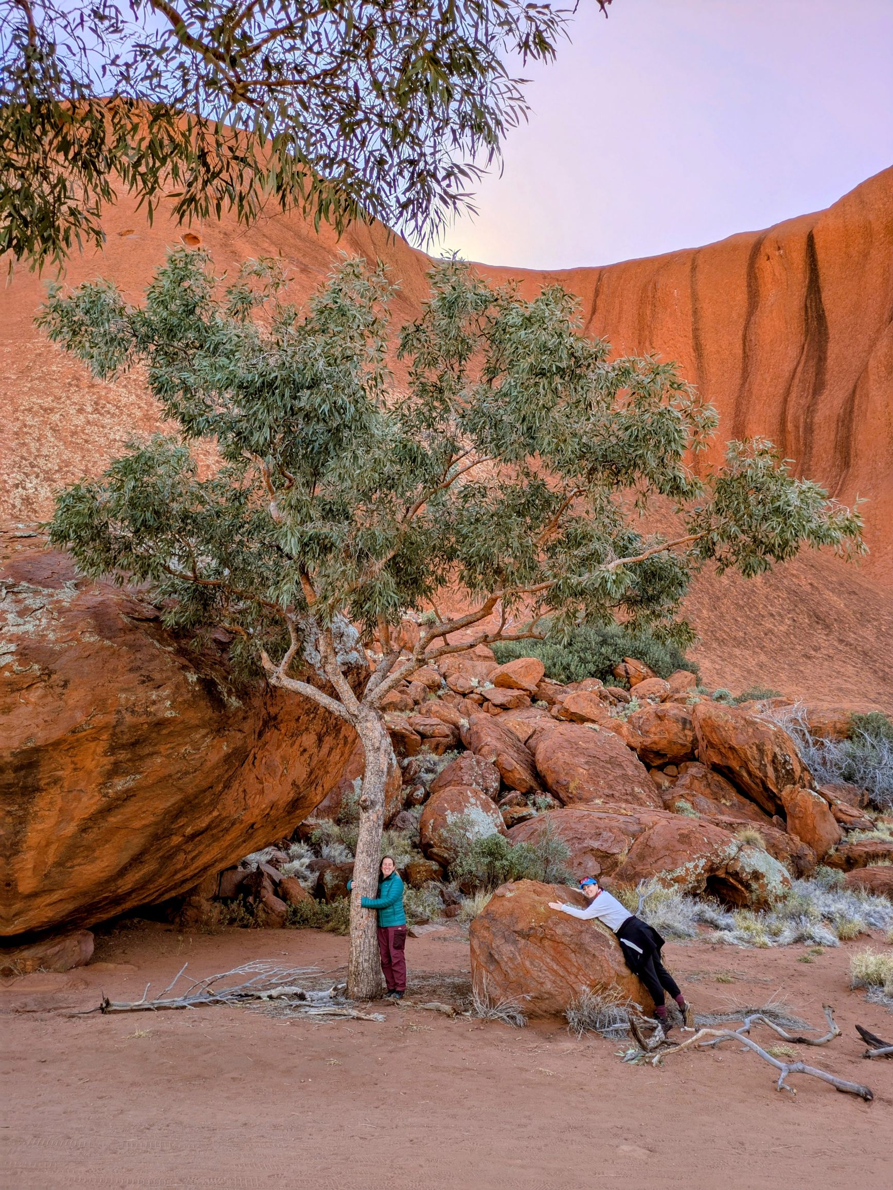
On our final day, we spent some time exploring the base of Uluru before we drove back to Alice Springs. When I first visited Uluru in 1992, we walked/struggled to the top of Uluru along with hundreds of other tourists and generally enjoyed the experience and the view from the top. This time standing at the ‘closed’ sign and looking up to see the path that I’d followed (and lost my favourite Hot Tuna hat to the wind), I again had lots of memories of that time and felt conflicted about the decision to follow that trail, however ill-informed and young I was. I also remembered it being really quite scary in parts because it was pretty dangerous going straight up on the edge of the rock with only a knee-high chain to hold on to which you had to share with tourists going both ways.
Em, Nic and I enjoyed walking around the base of Uluru and exploring the various nooks and crannies and caves and water holes. After a windy picnic lunch, we fueled up in Yulara, lined up a podcast series on Pine Gap and drove the 4.5hrs back to Alice.
We had a house through Airbnb in Alice Springs for two nights so we could get ourselves organised for our 9-day hike. We ate vegetables, did our washing and had good sleeps. Em and I visited the Desert Park which I highly recommend. I had 3 highlights in addition to the dingoes, emus and an Aboriginal food presentation.
1. The bird show was awesome – amusingly, a Willy Wagtail was the star of the show and wasn’t even a resident of the Desert Park – he was a self-appointed assistant to the bird show presenter. The Desert Park has the MacDonnell Ranges as a backdrop and there was an eagle soaring overhead which spooked the birds in the bird show including a curlew who hid behind the seats and a resident eagle who wanted to attack the wild one.
2. The bird aviaries were super cool with black cockatoos, finches, budgies and other feathered friends bathing in the waterholes and flitting between the gum trees.
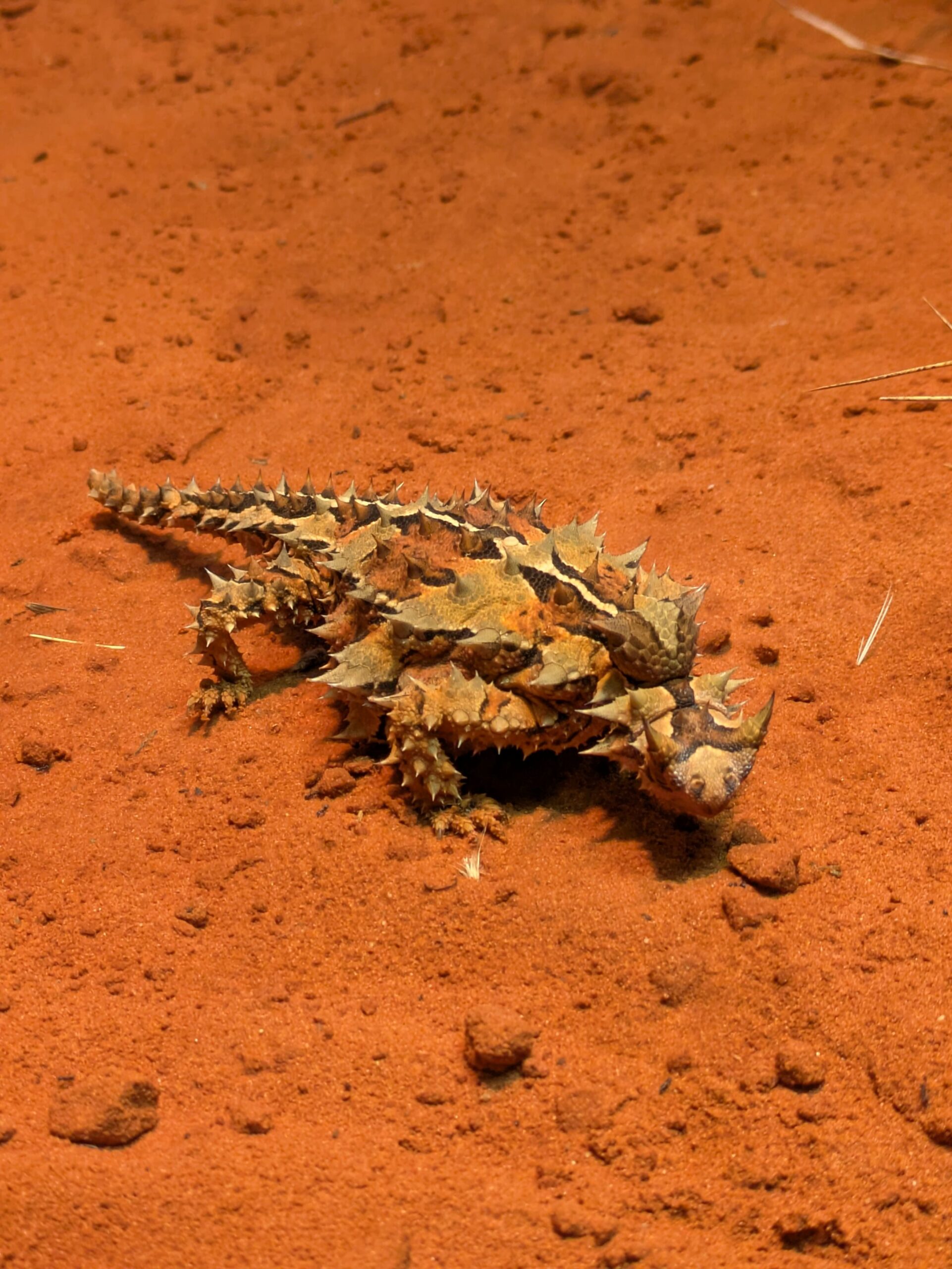
3. The nocturnal exhibition was particularly interesting with spiders, snakes, echidna, quolls, bettongs, curlews and the terrific thorny devil.
We also visited the dry Botanic Gardens and got to see the resident rock wallabies and roos relaxing, before packing our bags and getting ourselves psyched up for our hiking adventure.
Additional photo credits to Nic and Em – thanks for being wonderful travel buddies