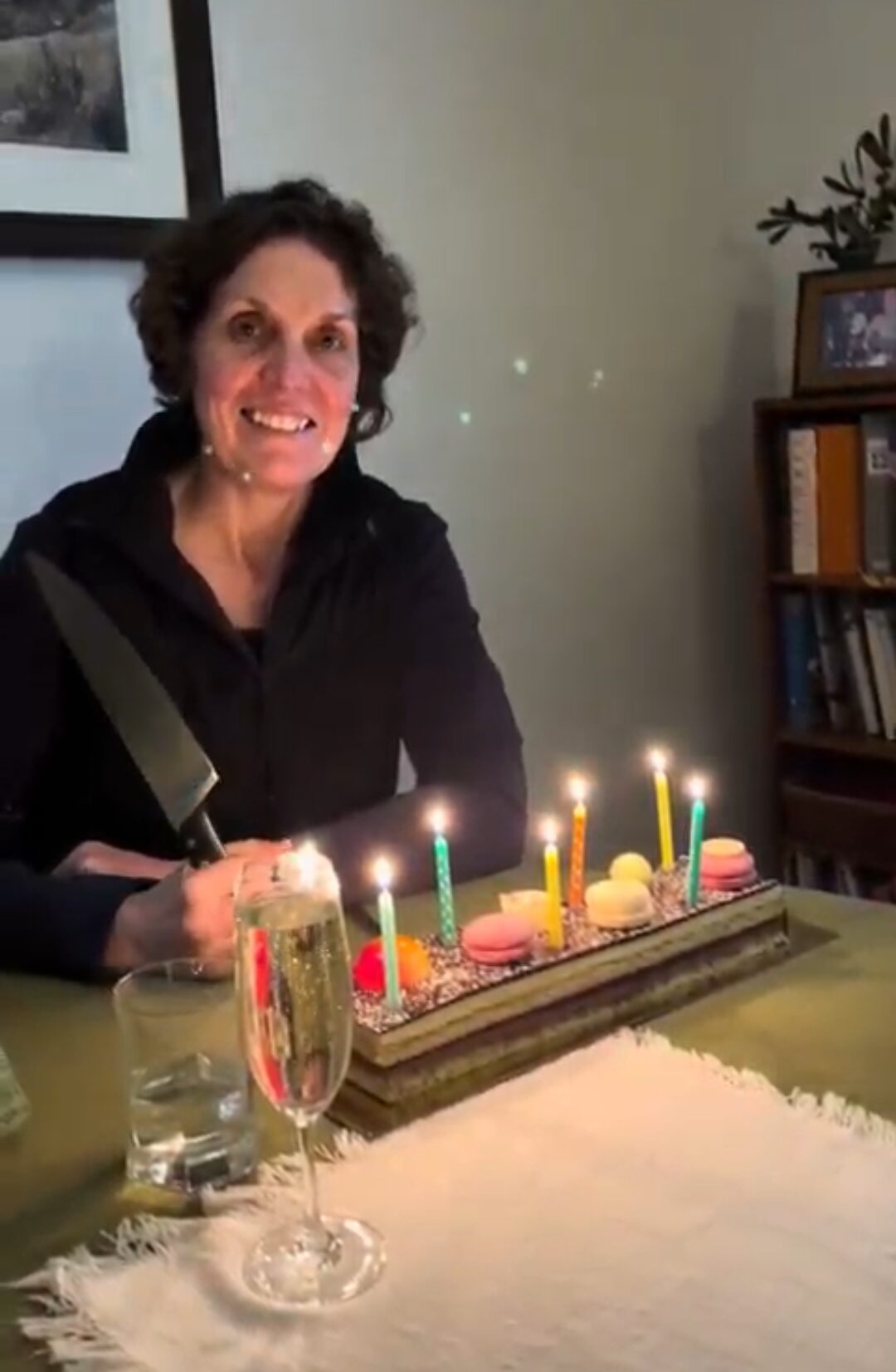
21 June 2025 – a memorable 46th birthday
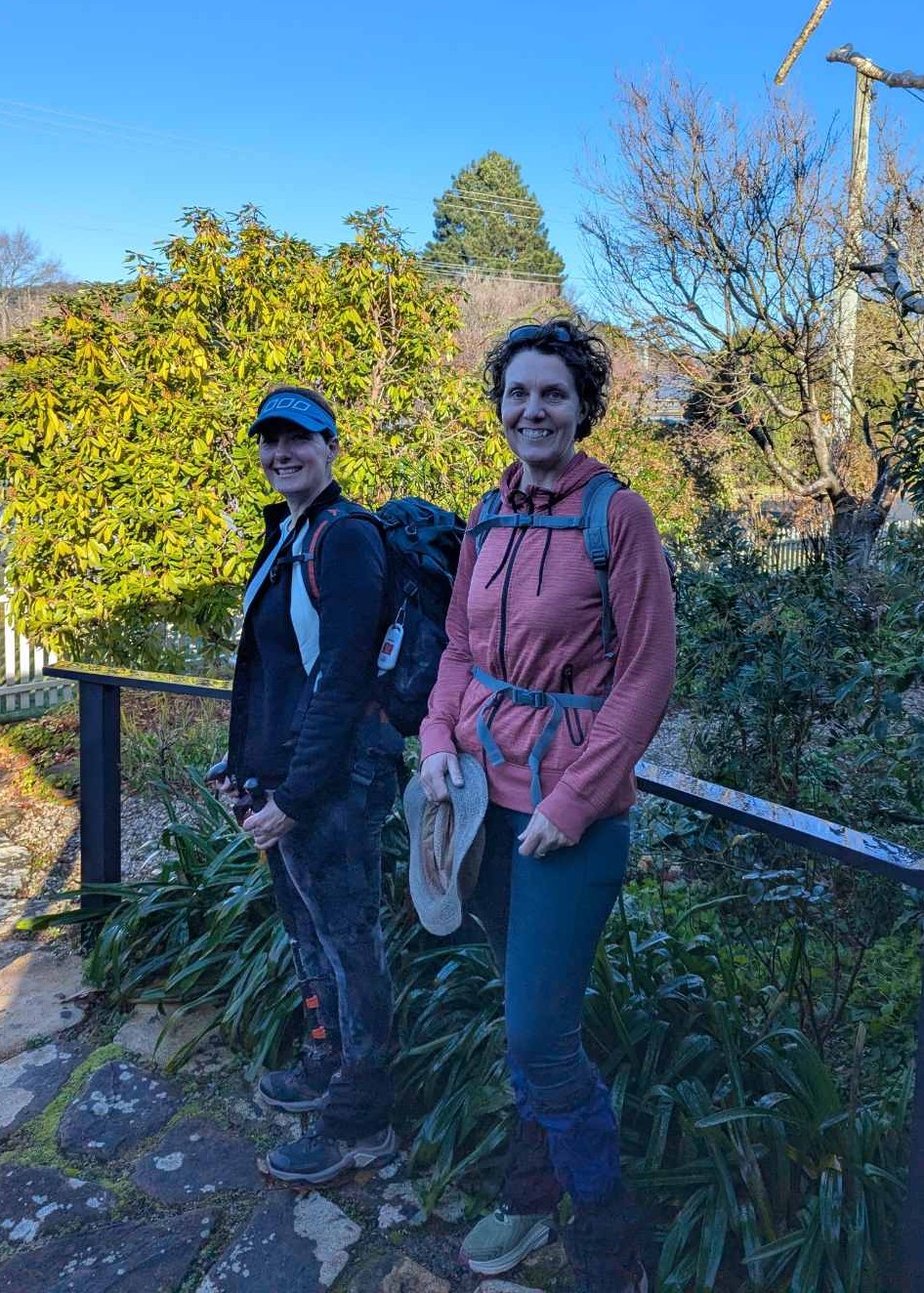
It was a bright brisk winter’s morning in Mittagong and my 46th birthday. My bonus-mum Sandra and her kitchen assistant, Neilo, cooked up a big breakfast of bacon and eggs to fuel Emma and I for our planned 14km hike into the Nattai National Park.
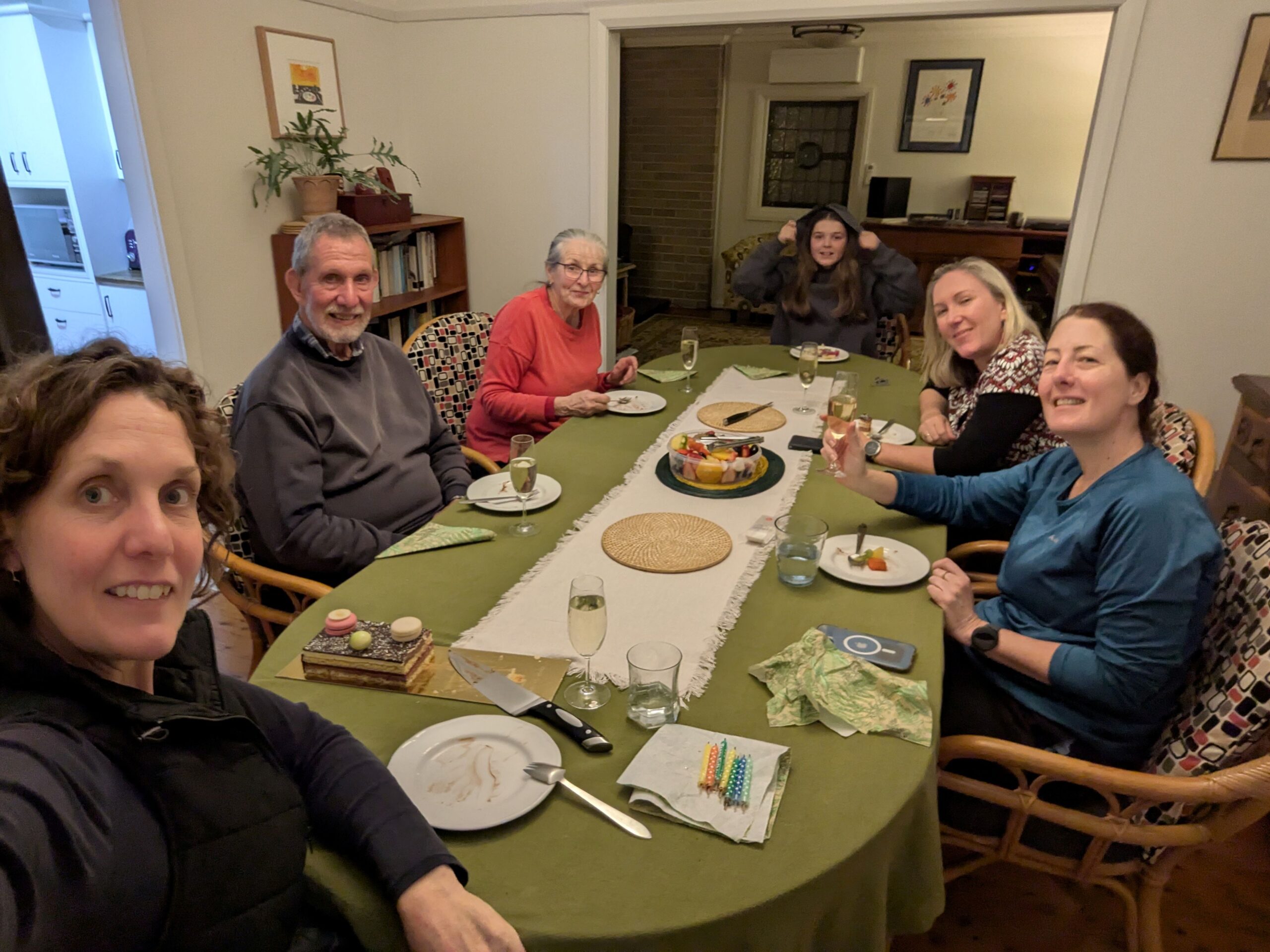
Em and I set out at 9:30am expecting to be back about 3pm to help Sandra in the garden, perhaps have a G&T as the sun set and be toasty inside by 5pm waiting for Tanya and Maddie to arrive from Canberra to join us for a tasty dinner to celebrate my birthday.
Em and I were in training for our Larapinta Trek and were testing out our gaiters, hiking boots and other hiking paraphernalia. As always, Em had ensured we were prepared for any weather event as well as having lots of water and a significant amount of snacks.
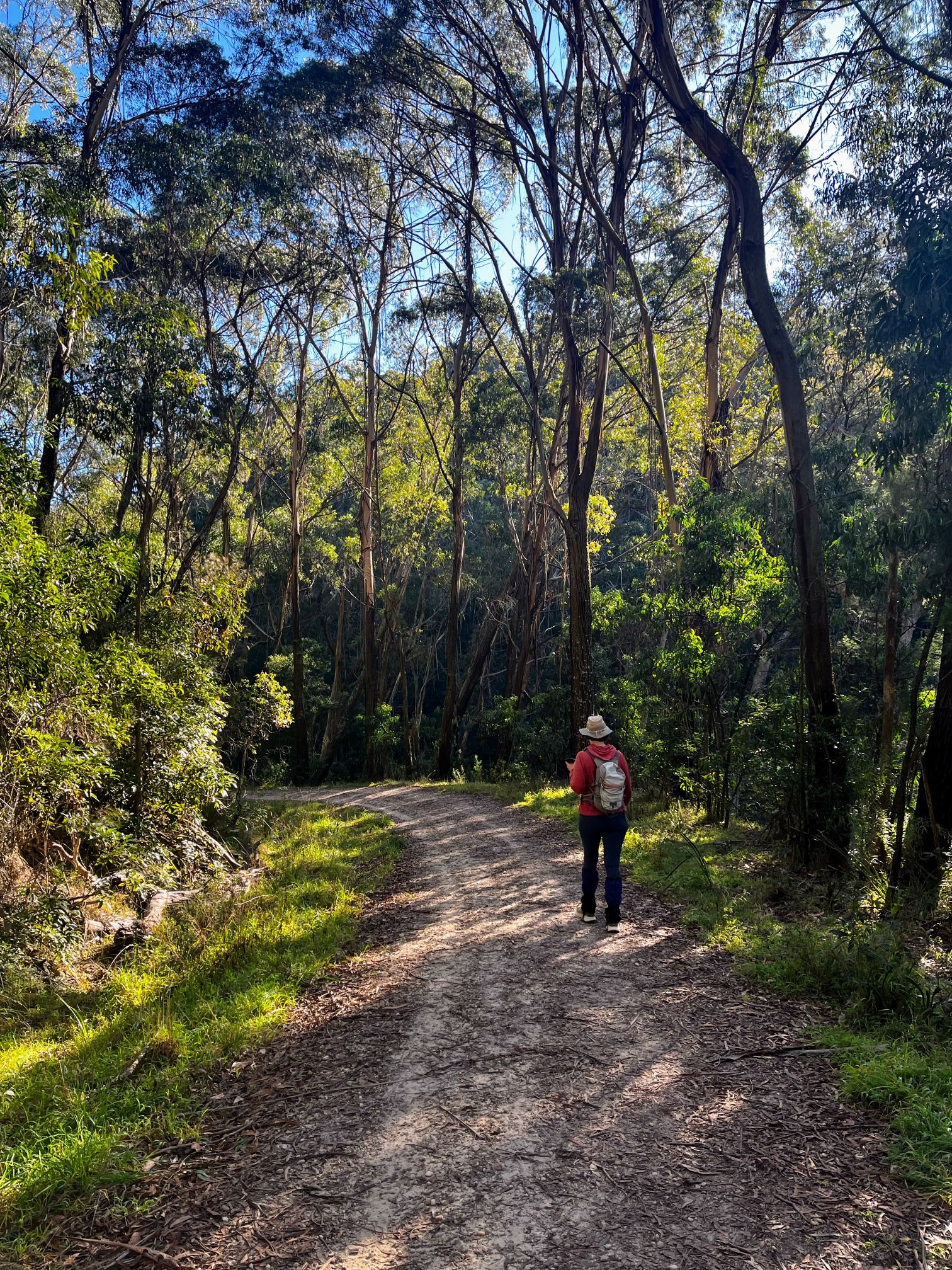
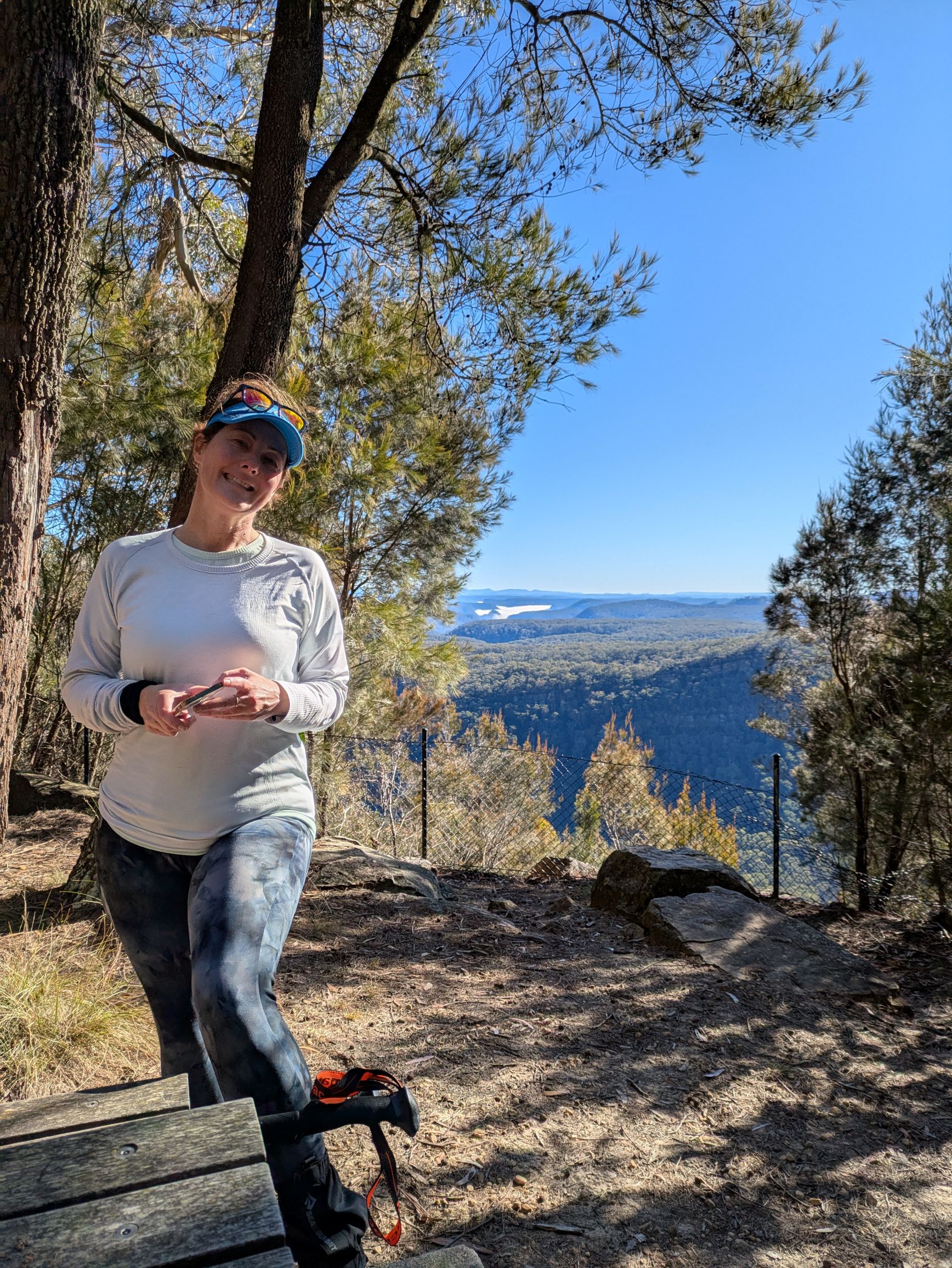
The frost on the grass was melting where the sun reached and the birds were warming up for a forecast clear sunny day. We headed north to walk around and then up Mount Alexandra to Katoomba Lookout. We stopped to do Wordle and send the obligatory Wordle location photos.
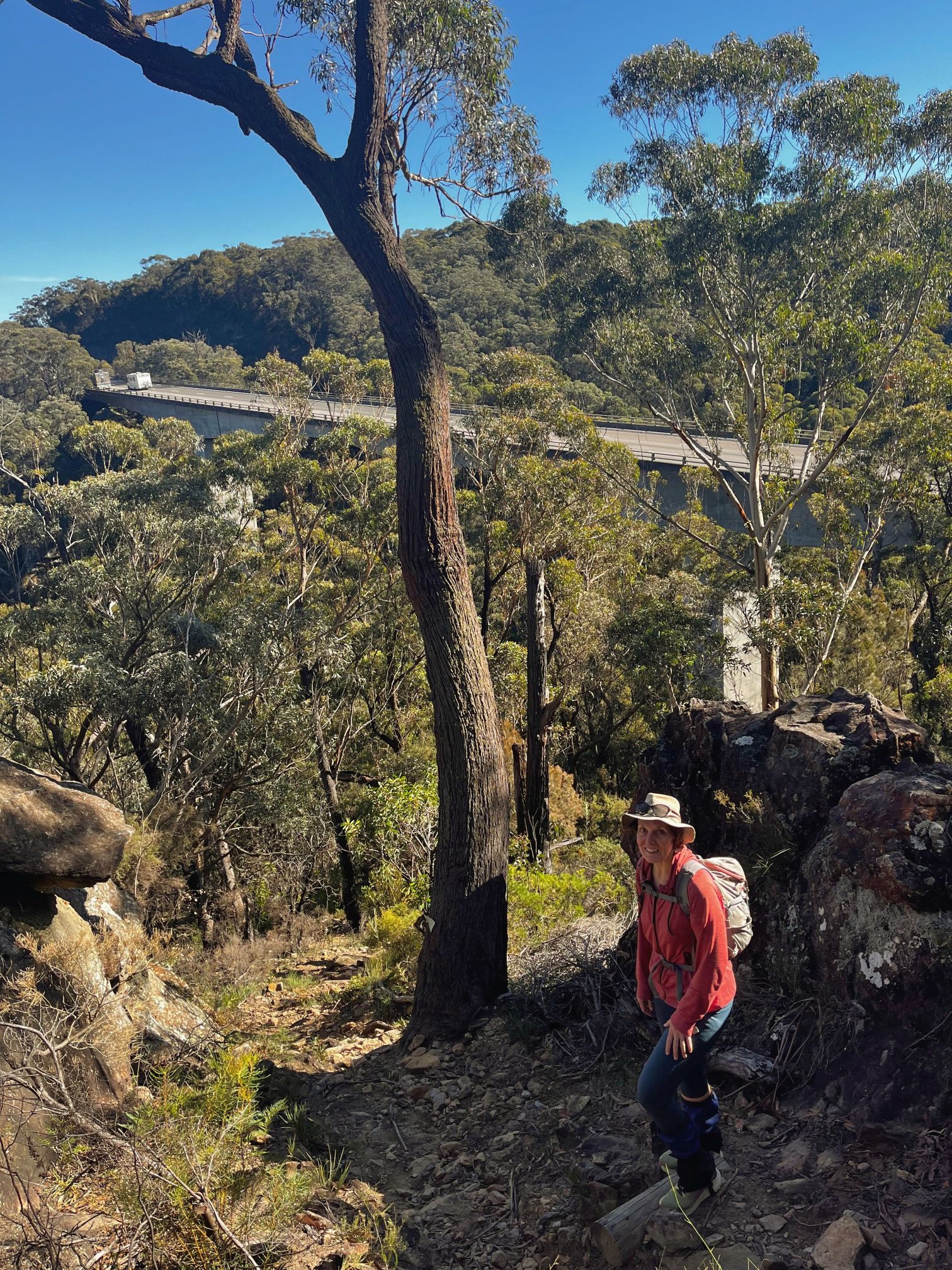
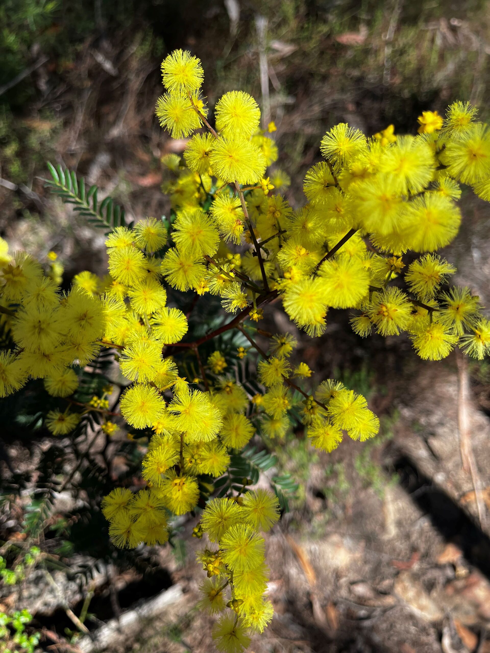
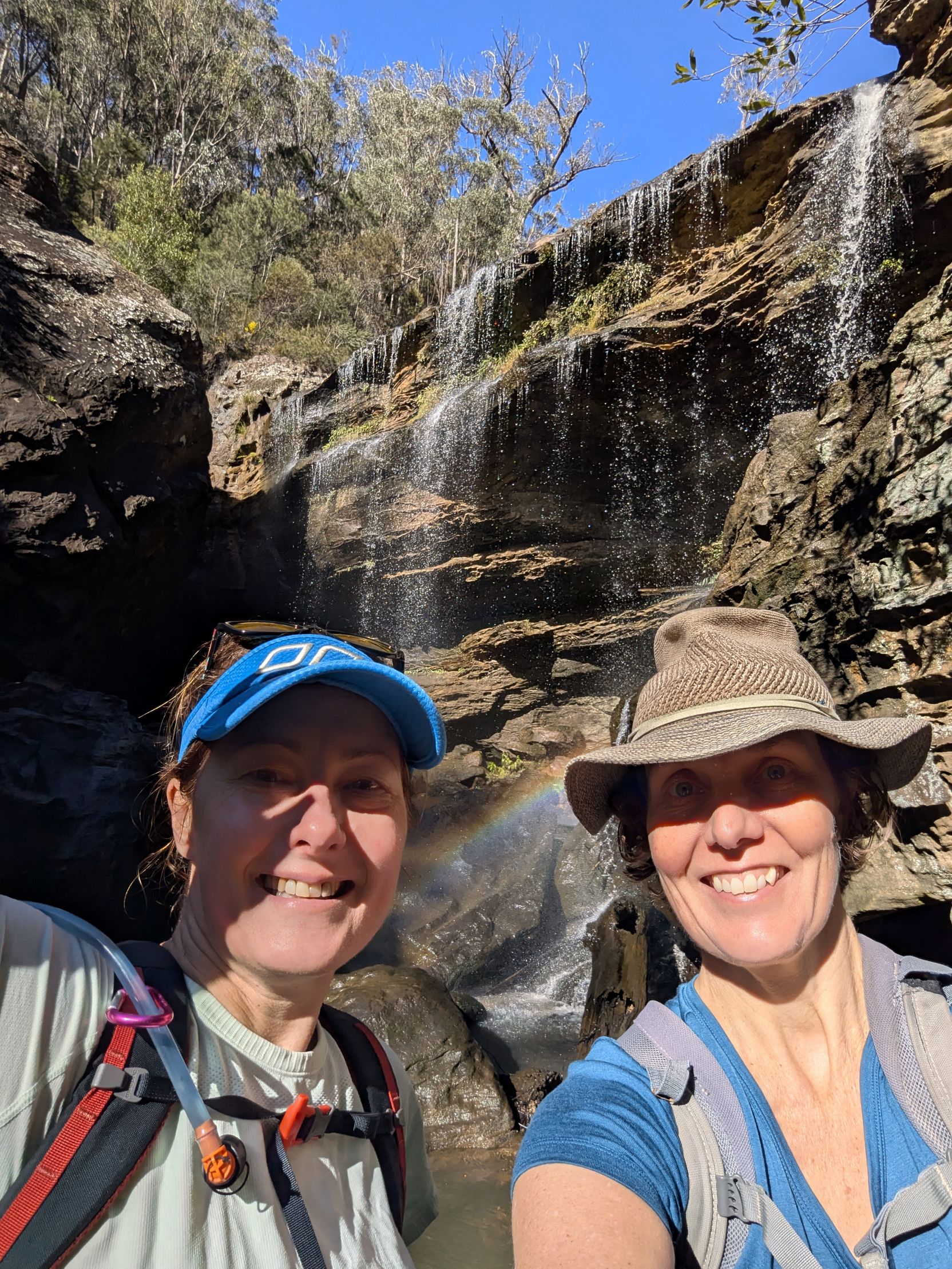
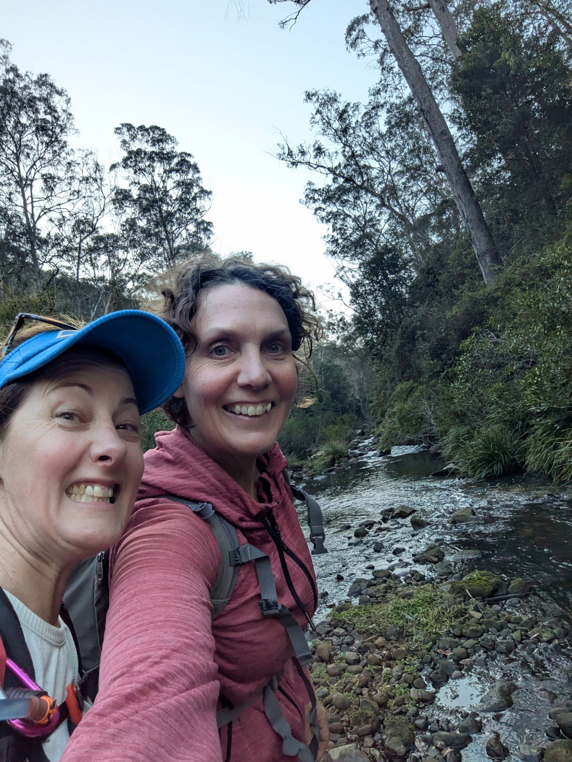
The bush was lush and green and the path was easy to follow as we walked down the north-western side of Mount Alexandra and under the Hume Motorway where we lost reliable mobile reception. A rock hop across Gibbergunyah Creek let us continue following the Nattai River north into the national park. The path took us to the picturesque Forty Foot Falls where we happy snapped and laughed at the influencers trying to get ‘that’ shot.
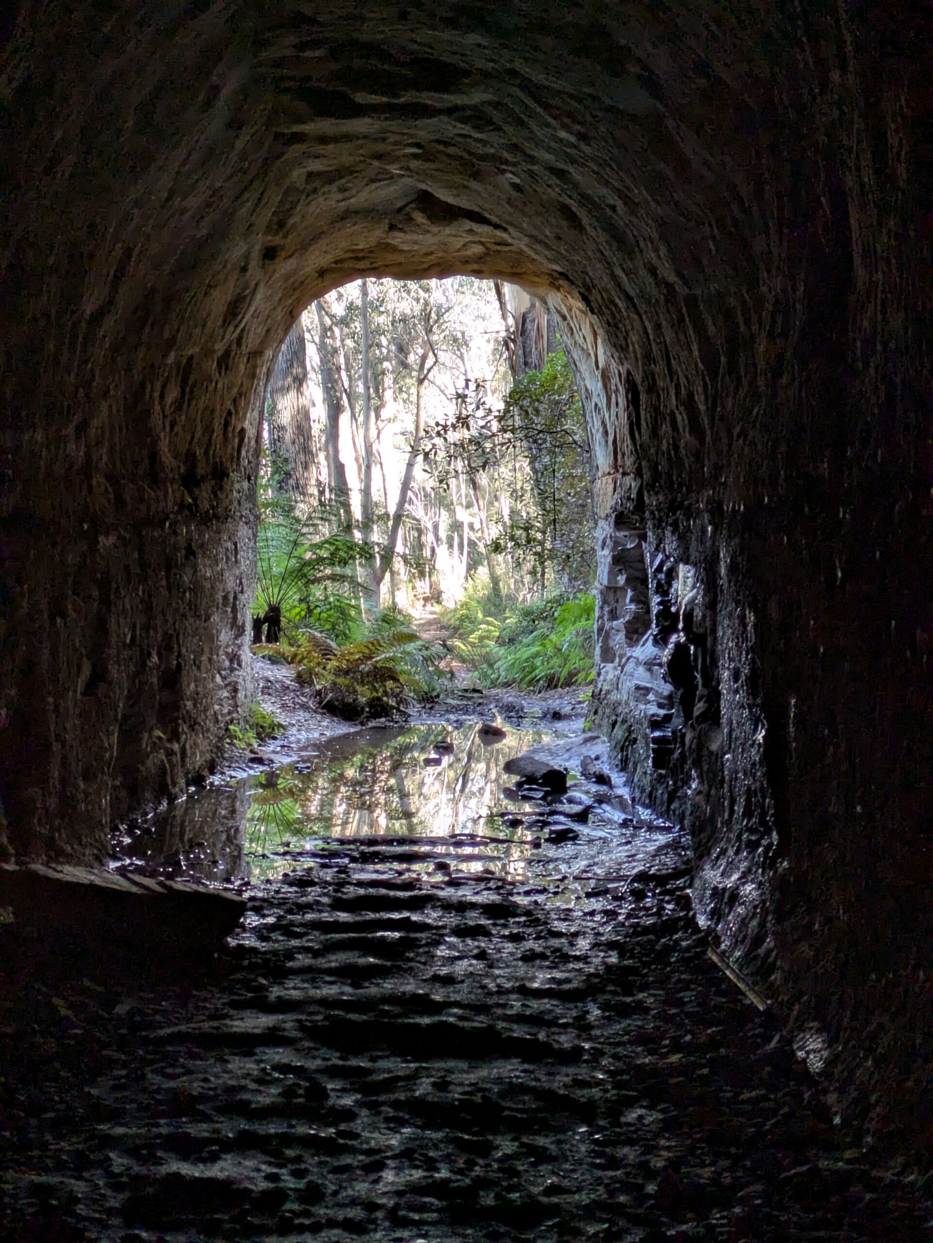
We then headed uphill to explore the Box Vale Mine track which follows an historic railway line completed in 1888 to haul coal from a mine down on the Nattai River. The railway was dismantled in 1896 but an 84 metre tunnel and beautiful sandstone embankments are part of the walking track today. We marveled at the amount of rock that was removed to build the tunnel and enjoyed the microclimate it created with patches of forest dense with large ferns.
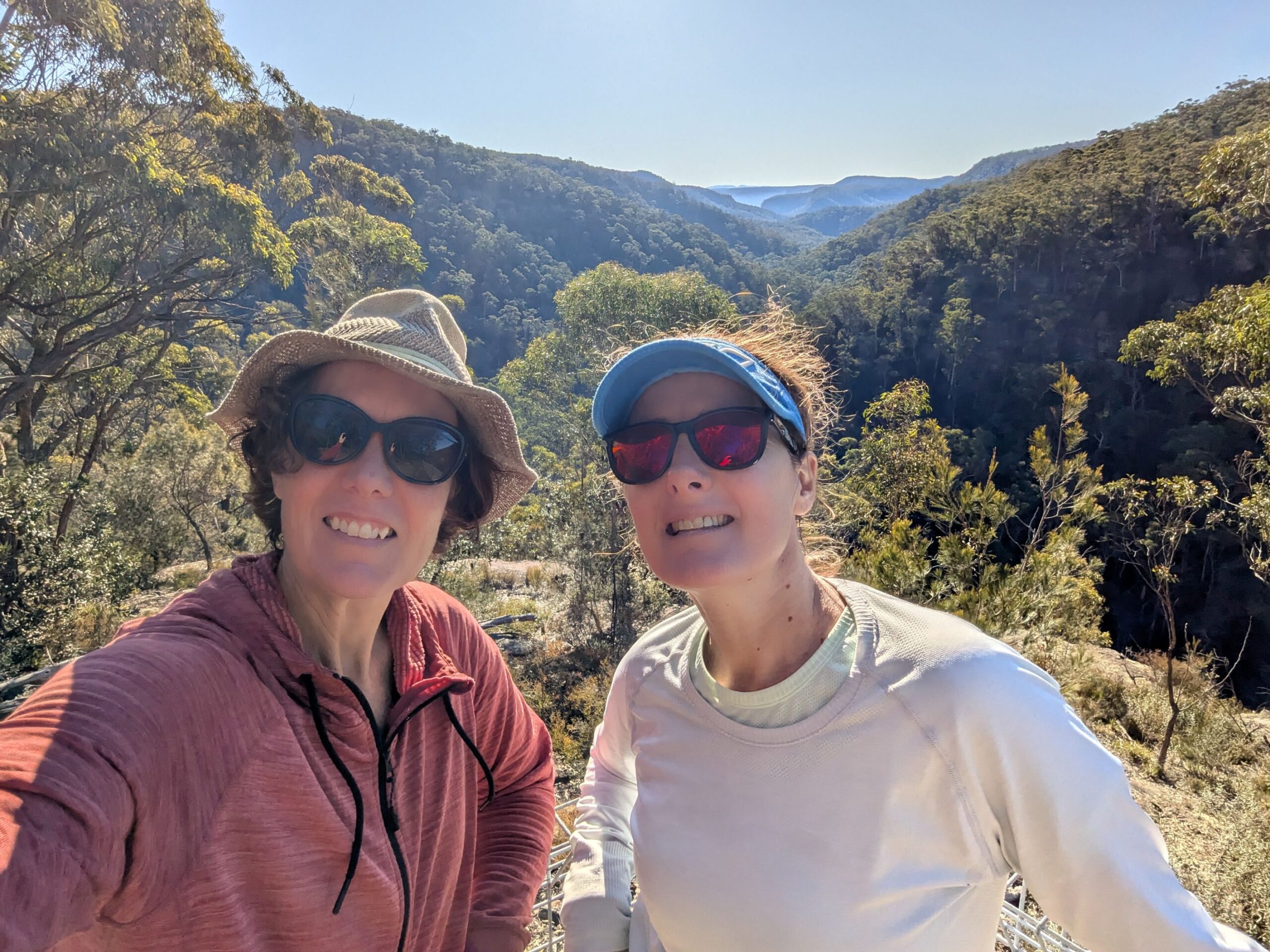
As we strolled on to the Nattai Gorge Lookout, we were surrounded by beautiful rugged Australian bush but were surprised and disappointed by the lack of birdsong. We lunched at the lookout and appreciated the crystal clear views to the Blue Mountains, with swathes of blue, green and purple as far as we could see. The trail thus far had been well marked and mostly leisurely.
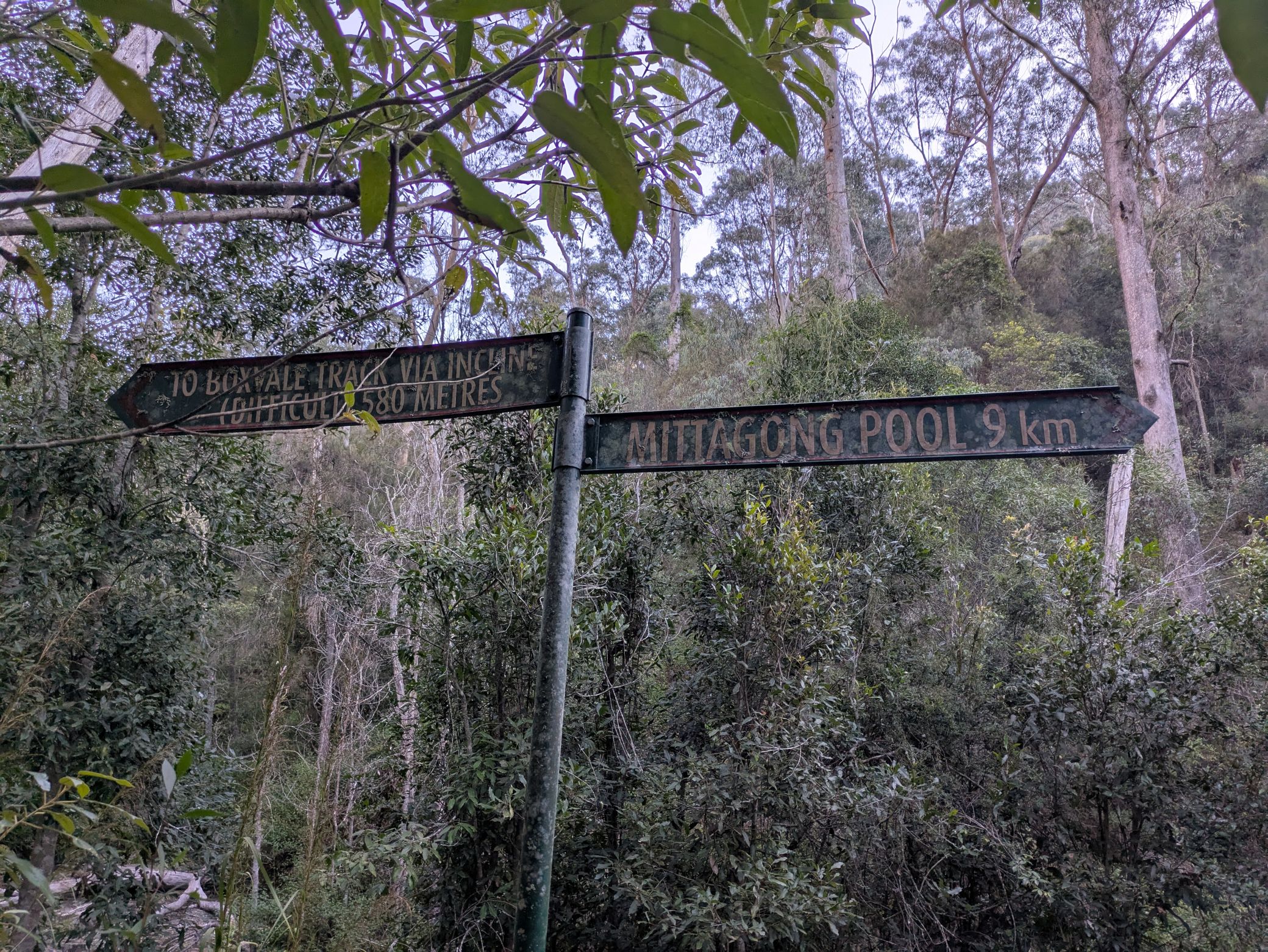
After lunch the plan was to head straight down to the valley floor and follow the Nattai River back to civilisation and a G&T. The Incline, which we were doing as a decline, was the coal hauling route connected to the railway, that was apparently in use for all of two years. A metal cable ran the length of the Incline to help hikers navigate the super steep bits. Em read the sign and reported that it was only 150m to the bottom. Easy, we thought.
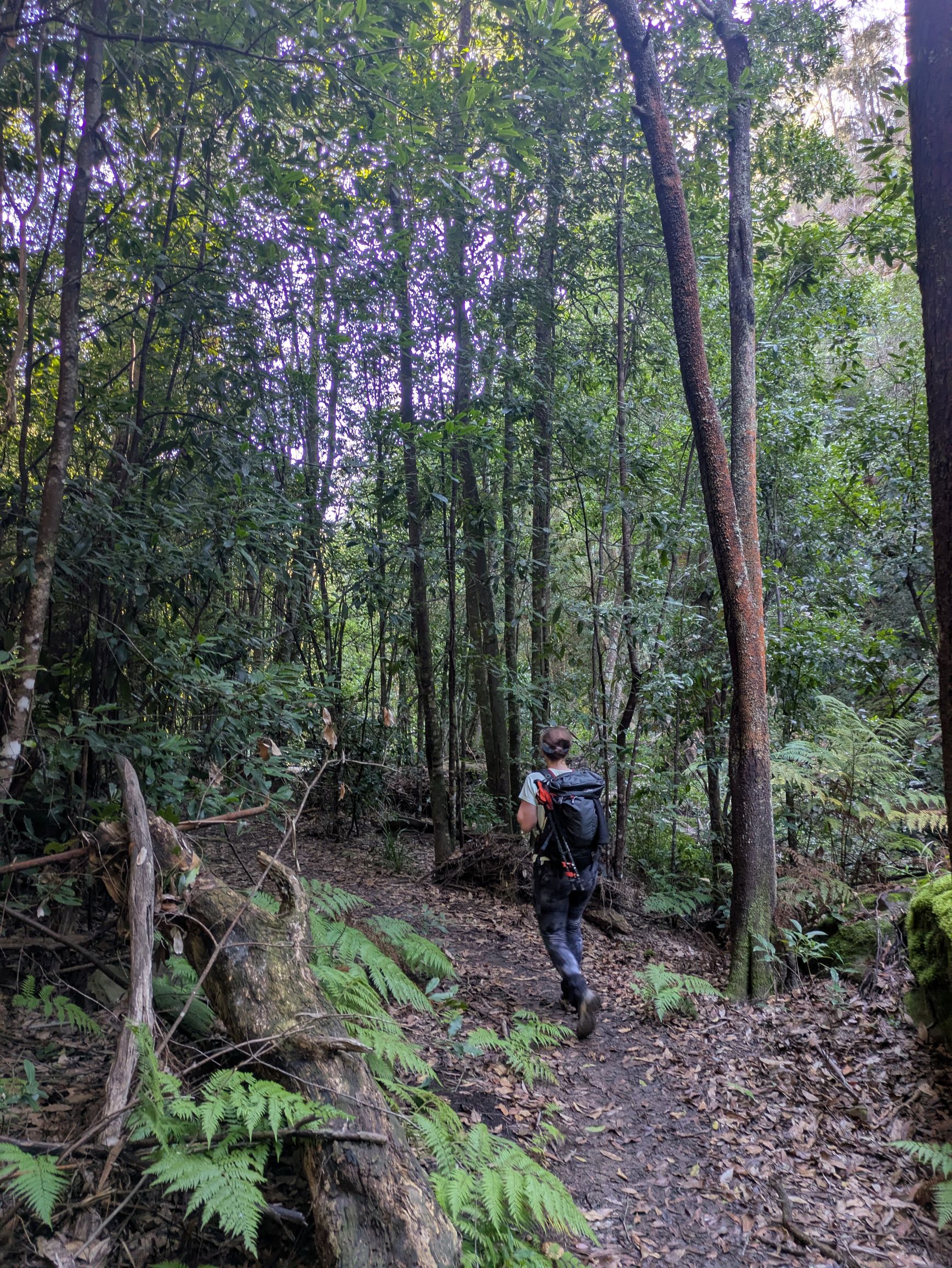
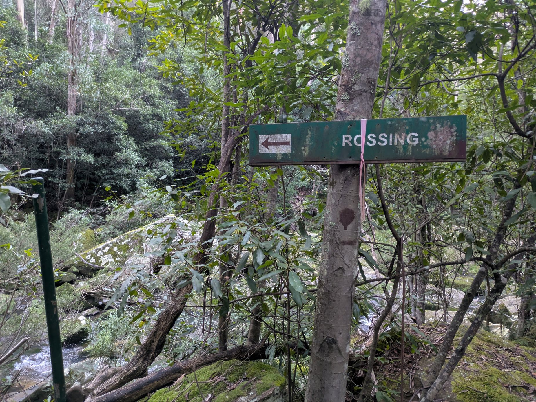
The Incline was rough and rocky, and generally not pleasant. We were starting to question the choice of path given the Incline seemed to be way longer than 150m and this section was very different to everything we’d done thus far. Turns out the Incline was actually 500m to the bottom and the 150m was the change in elevation. The mouldy sign at the bottom reassured us that Mittagong was 9km to the right and we were on track.
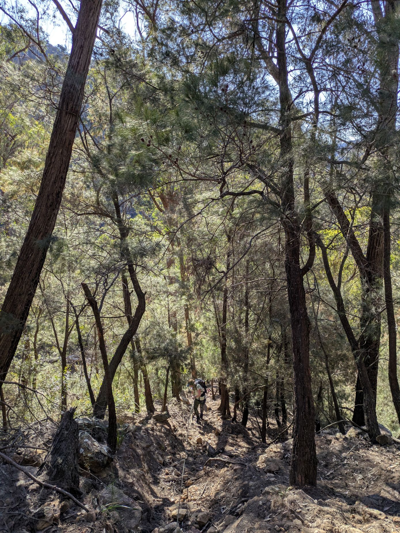
But then, where was the track? We followed the occasional bit of pink tape tied around branches of small trees, pushing through long grass and dodging fallen branches, but soon realised we weren’t on a path and according to my screenshot of the map, we needed to be on the other side of the river. So back we went to see if we’d missed a sign or a turn off, to no avail.
We considered going up the Incline and retracing our steps, but the 500m up was not appealing and we knew that if we followed the river, we’d get home eventually. How bad could it be?
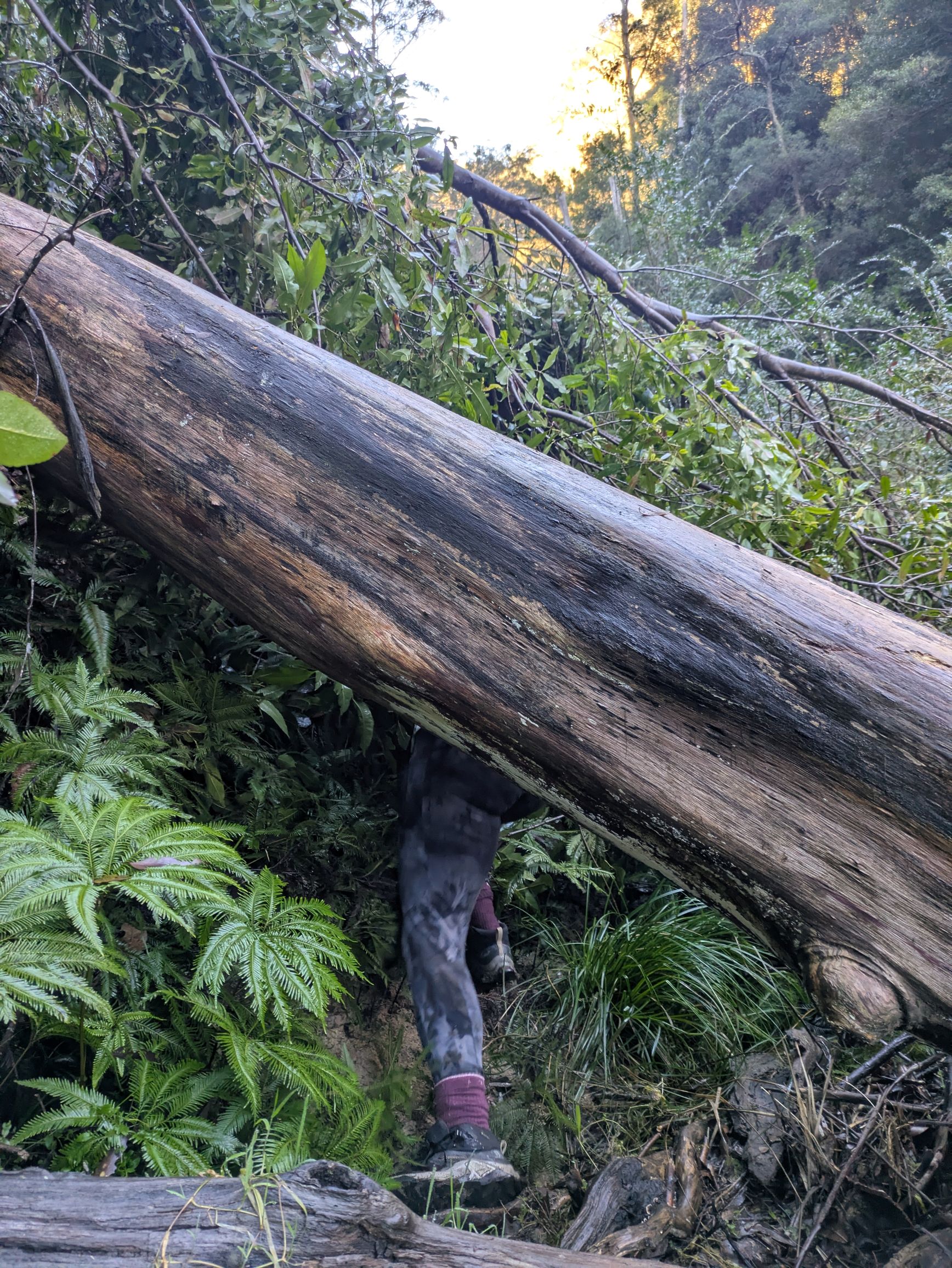
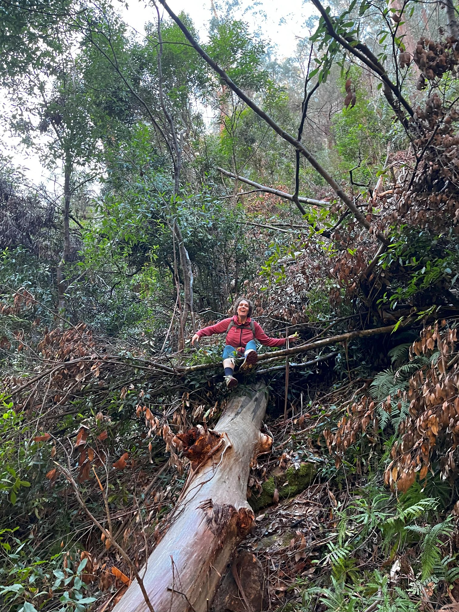
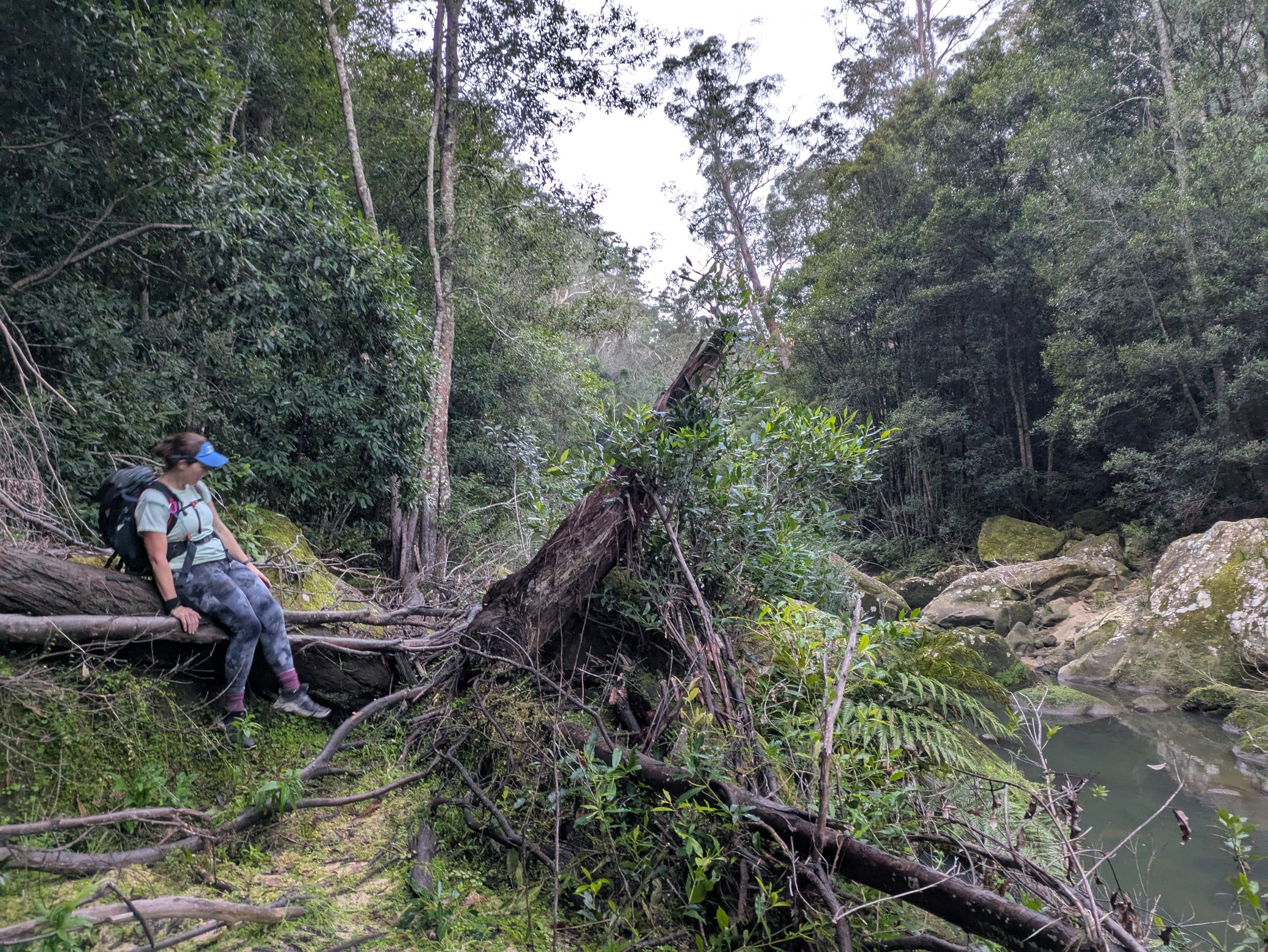
Well, in short, it was bad. There was zero path for the first 3kms and then there was only an occasional path. We forced our way through dense fernery, clambered over or crawled under huge fallen tree trunks, stomped over flood debris and scrambled around rocks and up cliff faces. We had to stop constantly to assess how to attack the next obstacle and check on each other’s physical and mental wellbeing. The sunset G&T was looking highly unlikely.
We had no mobile reception for most of the hike which meant we couldn’t tell Sandra until after 4pm that we were ok but running late. Needless to say, she was a bit stressed on our behalf.
Usually, I try to focus on the positives of my birthday being the winter solstice, aka the shortest day of the year. However today was not the day we needed the sun to go to bed in a hurry. We decided to save Em’s phone for torchlight and use my phone for navigating and communication.
We were running out of daylight and knew it would be extremely difficult and dangerous to navigate the mess of trees, debris, rocks and river crossings in the dark. We needed to get back to the Forty Foot Falls turn off to be confident of a path. We stopped for chocolate and a quick morale boosting hug before charging on like soldiers on a mission.
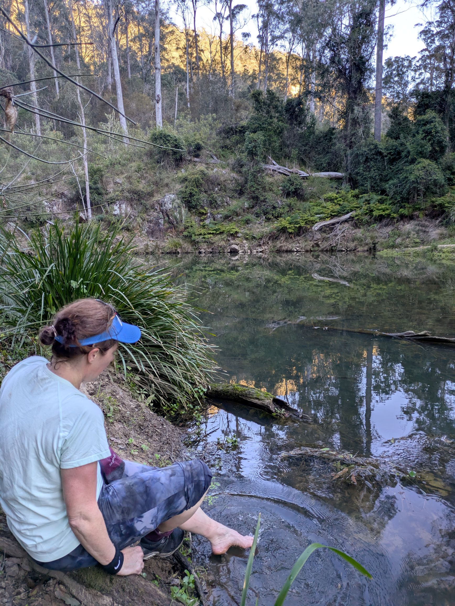
Walking by the river, we were optimistic that a platypus might pop up to give us a wave, but daylight died quickly and so did our hopes of seeing wildlife. Some owls kept us company in the pitch black. It didn’t occur to us to take photos to memorialise the adventure because we were totally over it. But here’s a map I made instead.
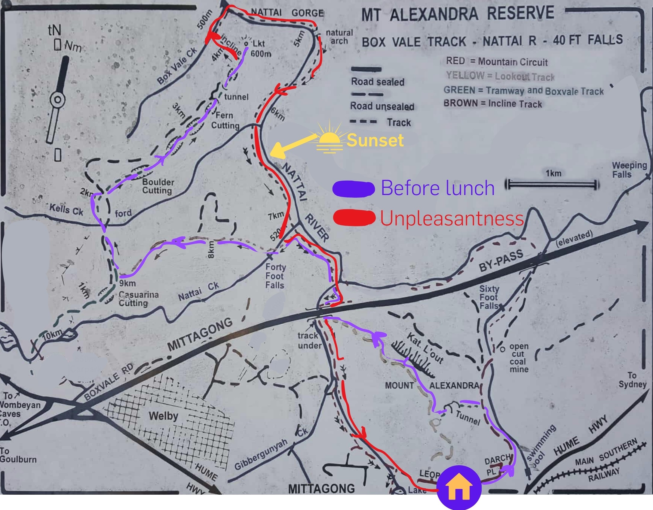
We trudged on, dodging obstacles as best we could, however I accidentally took us off course. Luckily the detour took us to a patch of mobile reception which was enough to tell us we were heading up the wrong creek but we were within cooee of the path. Hoorah!
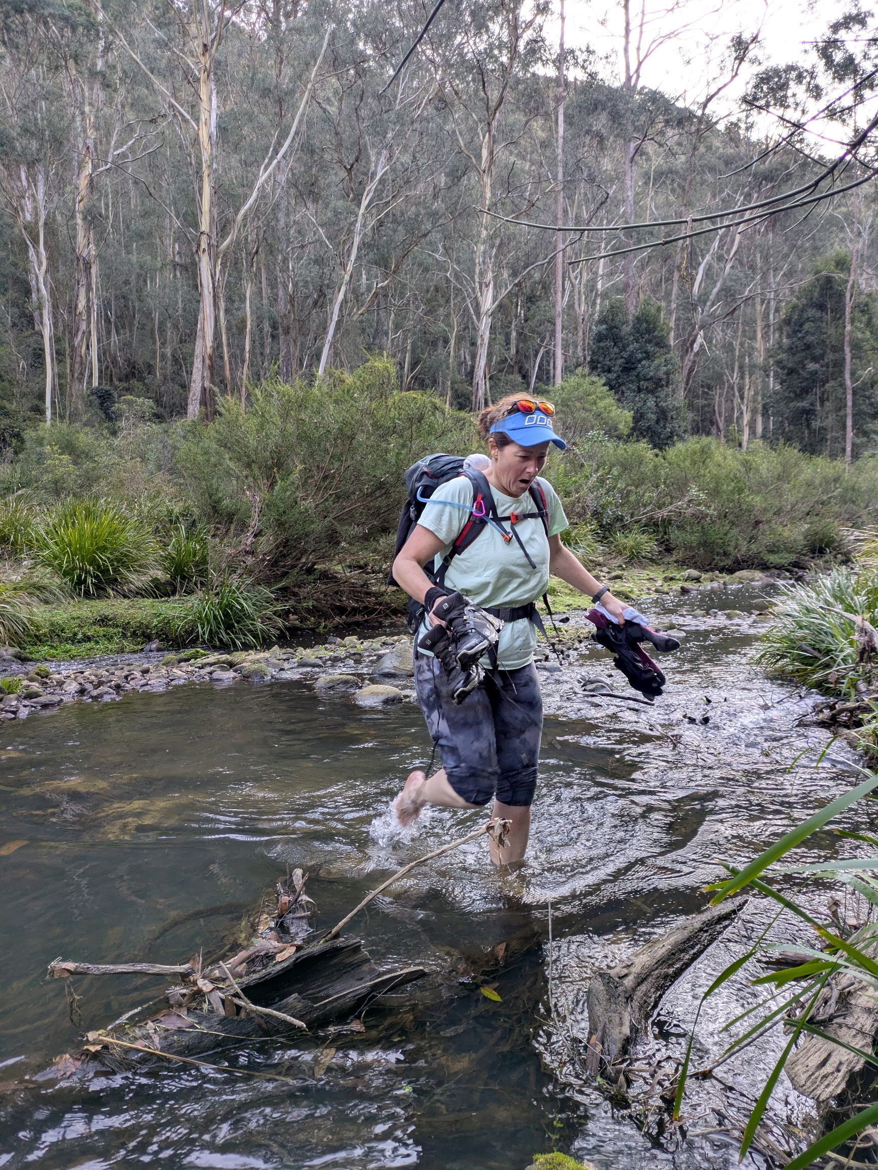
I slipped as I crossed the river and cut my knee but couldn’t see the damage in the dark so pushed on. The map said the path was perpendicular to us, about 30 metres in front. The problem was that the 30 metres was straight up hill and we couldn’t see! So Em took a deep breath and bush bashed like she’d never done before until she was nose first to a cliff face. But here was the path at last!
We stumbled on with the noise of the motorway getting louder and our stresses getting less. Em fell down a soft riverbank, I got stuck under a tree, I slipped in another river crossing and we both collected bruises. But we were on our way home.
I had done the final stretch of the walk previously, but I hadn’t paid attention to how long it took, so I was hesitant to guess a timeframe so I didn’t disappoint Em. Eventually our phones came into range, and we were 17mins away from a hot shower. We almost skipped home!
We were welcomed at 6:30pm by a room of much relieved faces as Em collapsed on the floor and I inspected my wounds. We’d walked 21.1kms in 9 hours. After a hot shower, we enjoyed a G&T and a scrumptious feast with wonderful people. A birthday to remember!
(Thanks to Em for still talking to me and even planning more walks together!)