Image: Dev at Gokyo Ri
Post 2 of 6
22 September 2022
I have recently recognised that I am a ‘Greeter’. That is someone that likes to acknowledge people coming the other way. Therefore the Sanskrit salutation of ‘Namaste’ common in Nepal and the Indian sub-continent was my word of the trek. I love it because in addition to being a polite and friendly greeting, it is a sign of respect and essentially negates one’s ego in the presence of others – hence the bowing of the head and palms together at the chest. What a wonderful way to acknowledge and value someone. So despite only showering once in 3 weeks, drying my handwashed underwear on my backpack as we trekked and looming above the locals by a good half a metre, I felt welcome by greeting others with Namaste, a bowed head and a smile.
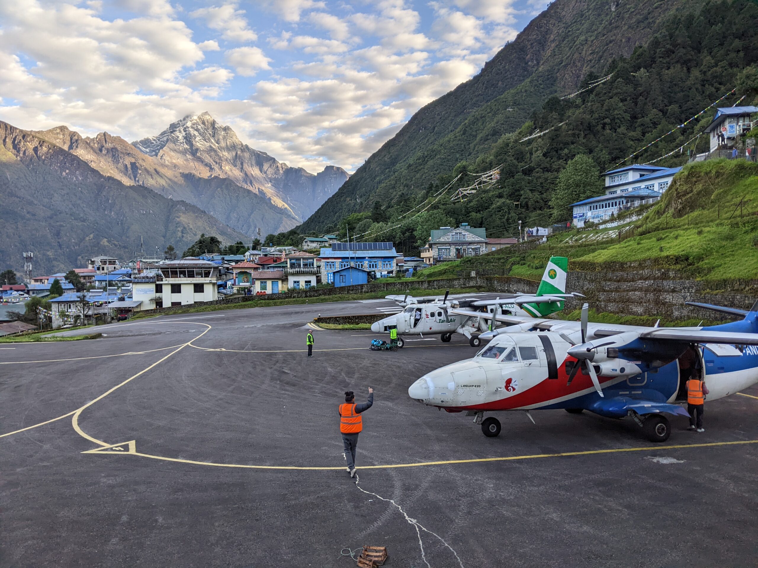
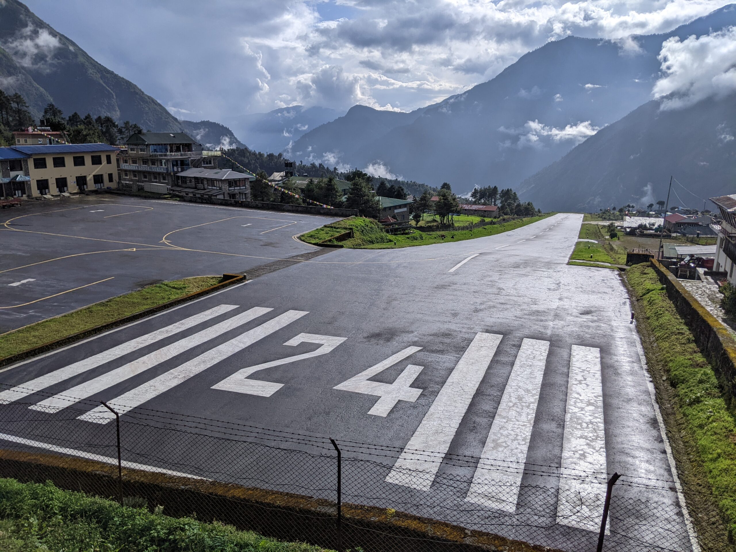
After a few days of feeling dazed and delirious lost in the intensity of Kathmandu, Hans and I were hurried on to our dawn flight to Lukla as the skies were clear and the weather ideal for landing on the “most dangerous runway in the world”. The airport is squeezed onto the side of a tall mountain, lush with green forest, with the 527m runway sloping upwards towards the mountain to help the planes slow down on landing. The pilots are expert in navigating the terrain and only fly when the weather is absolutely safe to do so. We were the first flight to get to Lukla in 5 days given the lingering monsoon so the plane was back in the air within 10mins of us landing to collect another load of trekkers from Kathmandu.
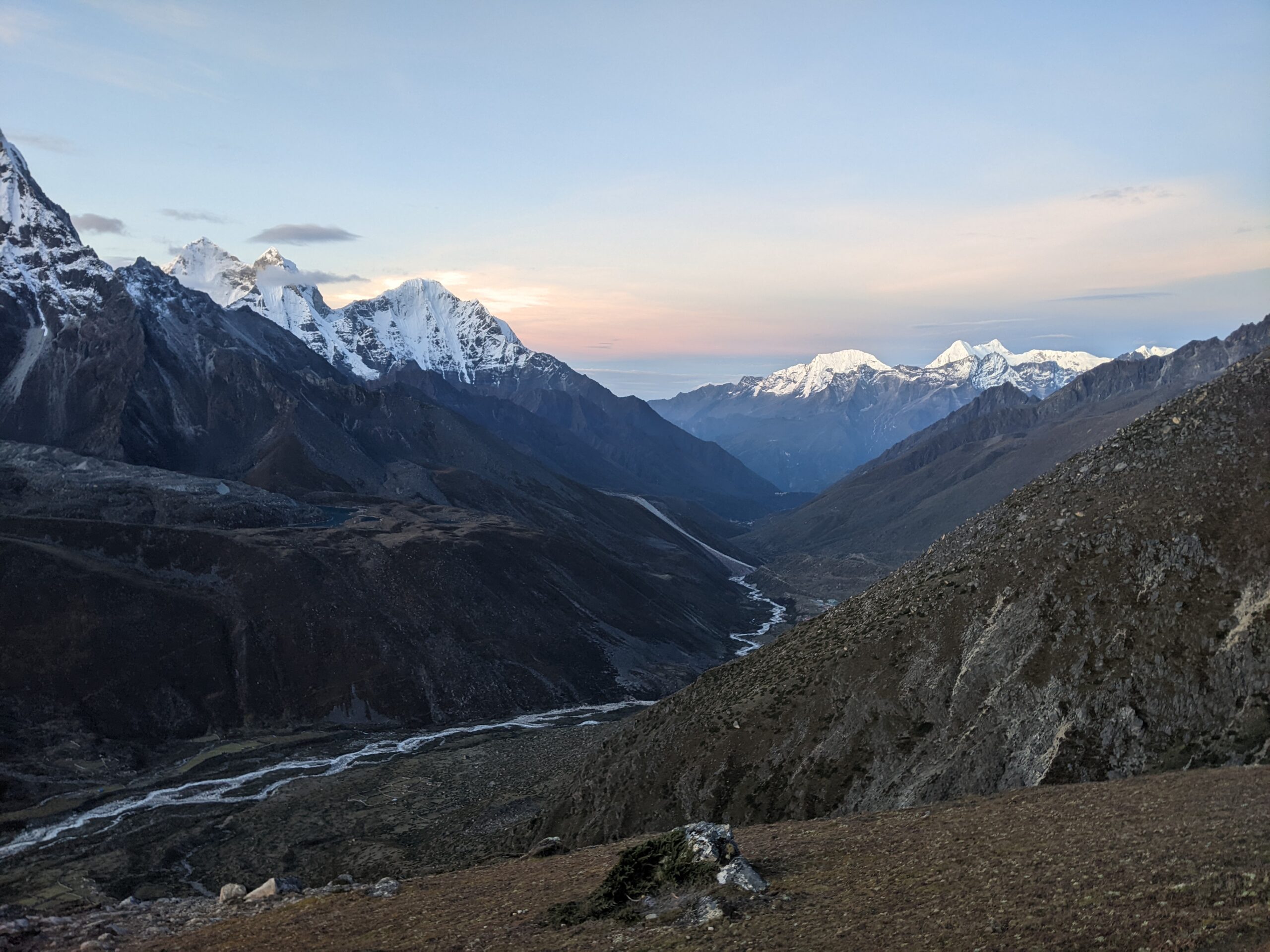
That day we walked out of the photo to the left, followed the mountain around behind me and down to the river, and then walked up the hill in the middle to stay just behind Dev’s head at Tangboche 3860m.
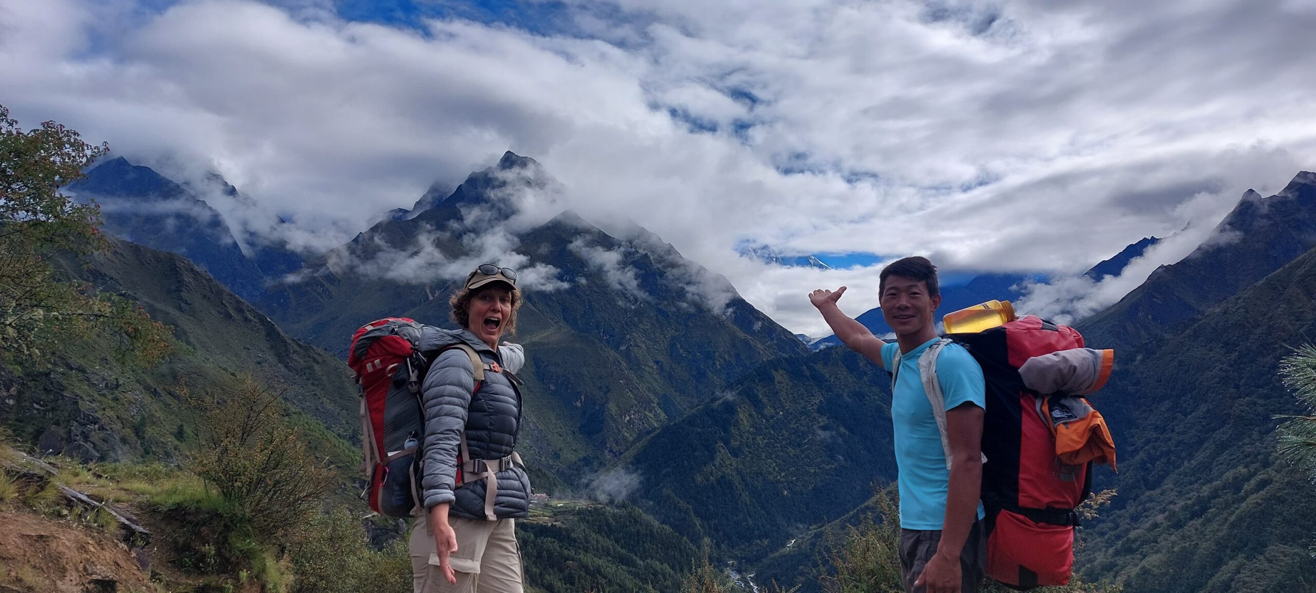
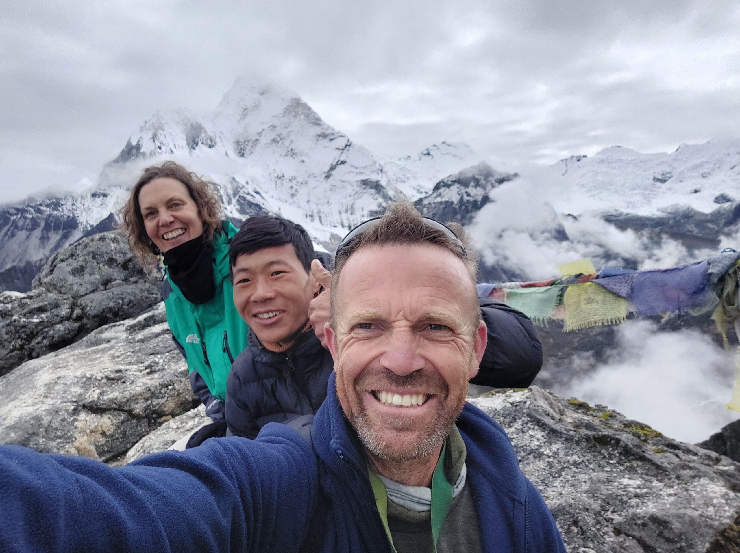
While we met many people who were doing the trek on their own with a map or guidebook (and some without either!), we had decided a guide would save us some stress and we could help the local economy. Our guide, Dev, was a 24yo Nepali who had walked 2 days from his village to meet us at the airport. It took us a bit to process that he had walked that far, but we soon understood that there is of course no motorised transport in the mountains and that destinations are measured by time to walk rather than distance given the huge variability in terrain.
Poor Dev was a bit overwhelmed by our excitement, our height (6ft) and our accents. Despite the name, Hans is a fair dinkum Aussie with matching vocabulary. He is as curious as he is friendly and has an amazing ability to start an affable conversation with anyone. Dev couldn’t understand a thing Hans said for the first 2 weeks, and I fear we may have taught Dev some poor vocabulary choices…
We were pretty pleased with ourselves…
The timing of our September trek was a gamble with the weather as the monsoon usually finishes ‘sometime’ during the month. But we were happy to gamble with the weather to avoid the crowds. October/ November is peak season with guaranteed clear skies attracting +15,000 tourists to the Everest region. That’s too many people for my liking.
Having said that, one of the best things about adventures like this are the people you meet along the way. The Three Passes Trek is the road less travelled and is therefore travelled by those who are particularly inspiring and adventurous. We walked a few days with two young women, each doing the trek on their own: a crazy and kind Kiwi Ranger who swam in the glacial lakes and wore shorts most days and a super bubbly German psychology student who had booked her trip at the last-minute trusting she would find some nice people to walk with. Phew! We shared stories with some peculiar Israeli adventurers, a gaggle of Japanese men in their 60s, a crew of inspiring Russians, a constantly excited and therefore loud Mexican family, a towering Dutch army officer who had protected the royal family, a fascinating British finance chick who wants to open a cheese shop in her native Ireland and a young Indian woman researching the origins of the Honeysuckle flower for her PhD (apparently the origins are in the Himalayas…).
I mentioned in the first post about the approximate spellings of localities and inconsistent altitudes quoted. A trusty source of wisdom that travelled with us was ‘Trekking in the Everest Region’ by James McGuinness. The book explains that Sherpa is a mostly spoken language and as people and authorities sought to create maps of the Khumbu Region and transcribe the names of places, a variety of spellings emerged. For example, Thangnak is also Dragnag and Dragnak. Confusing yes! The quoted altitudes of villages also vary but this seems to reflect that the villages are generally always on sloping terrain and the village can encompass a broader area than the ‘township’, which means one part of the village could be 100-200m higher than another part.
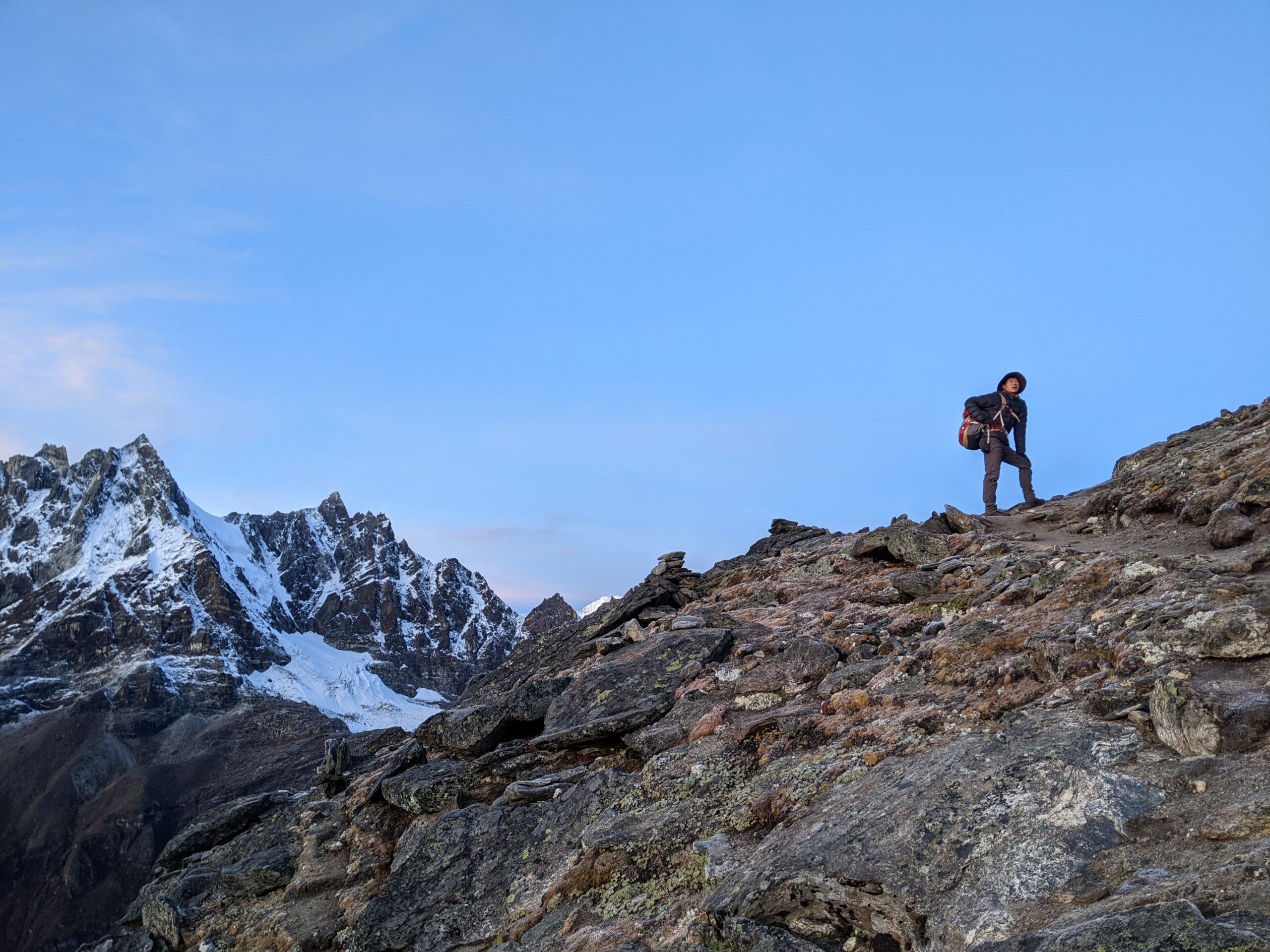
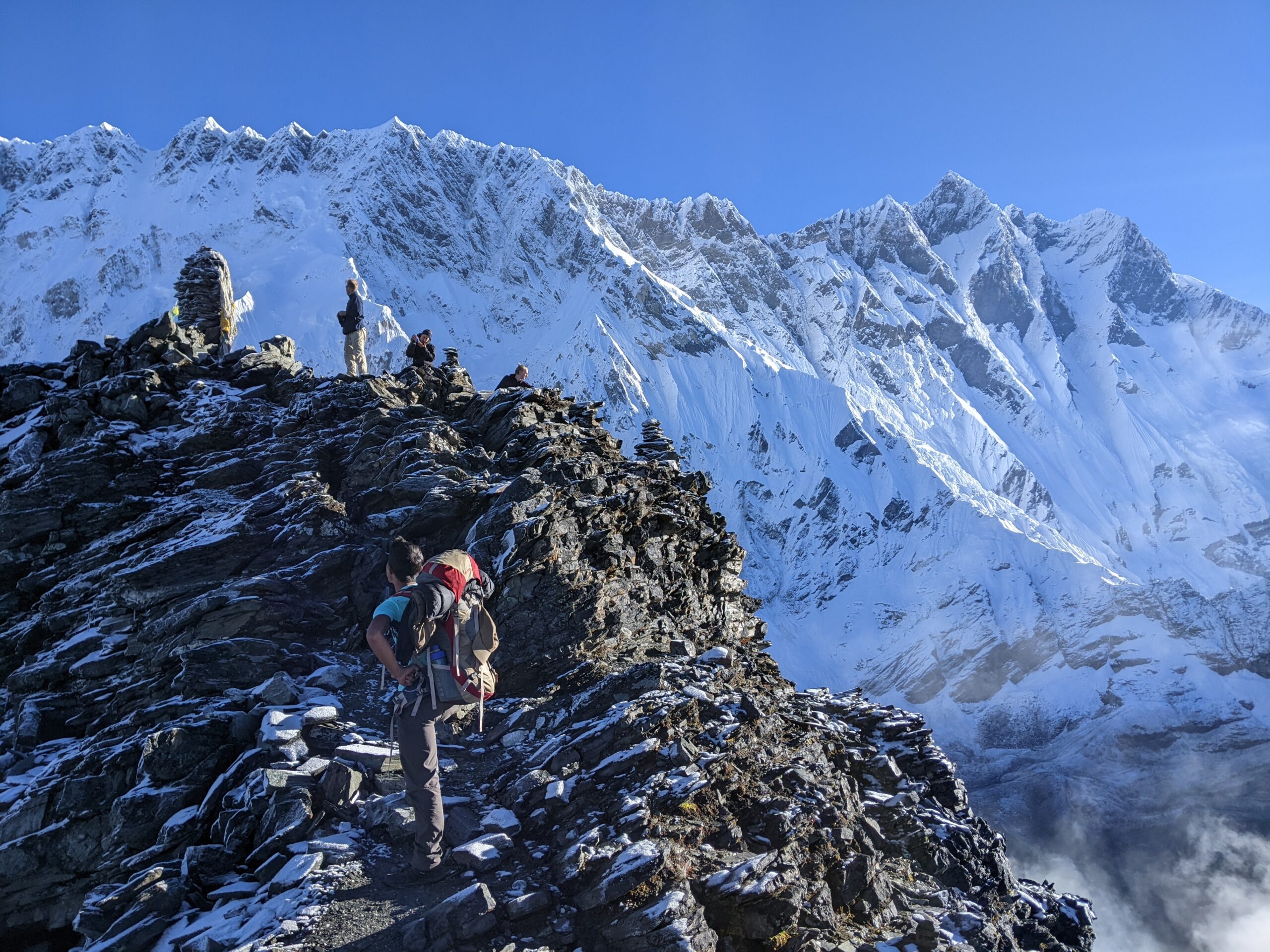
This was our first mountain pass of the trek and we were pretty nervous about the quality of the path, the weather and the altitude.
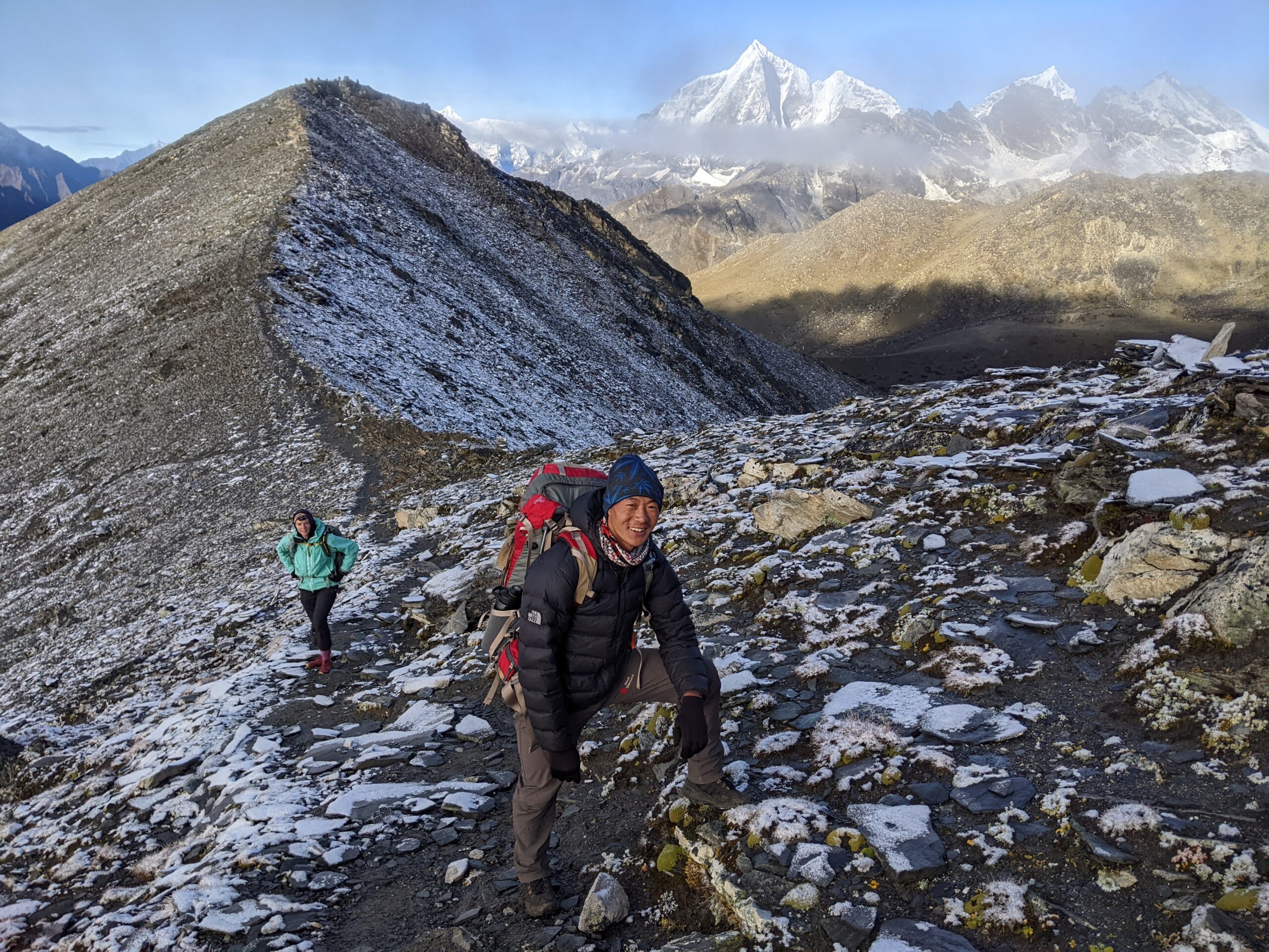
We had a supportive crew plus a friendly dog, Anubis, to make sure the day went well.
The photo above of Dev & I, while still in the green mountains, is taken way down the end of this valley.