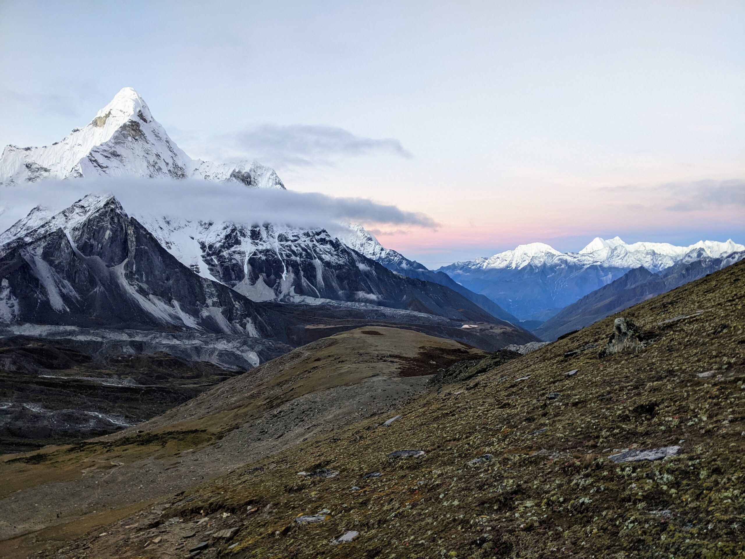
Image: sunrise from Chukkhung Ri
Post 1 of 6
18 September 2022
In the interests of avoiding work, I let myself be talked into going to Nepal to do the 160km Three Passes Trek in the Everest region. I did a lot of research and preparation for the trek, but with something like this you cannot truly understand what you have committed to until you are there doing it. In short, the adventure was challenging, the people were wonderful and the experience was magic.
Nepal itself is home to 30 million people and is smaller than the state of Victoria. It is sandwiched between India and Tibet/China, with the ‘Top of the World’ Himalayas commanding the north of the country and sea level plains leading south into India. It has 5 climatic zones broadly aligned to the different altitudes and apparently has 5 seasons – that is the usual 4 plus the monsoon.
Just to confuse things, clocks in Nepal are set to GMT+05:45. (There are only 3 time zones in the world that are not on the hour or half hour). Locals say they like it that way because they are 15 minutes ahead of India (which is important for a small country to differentiate itself from its overbearing neighbour) and it is a convenient excuse to be a little late to appointments.
While the Three Passes Trek route involves about 160kms there is a lot of random meanderings and side treks to add to the kilometre count. Standard tours trek for 17 days, but we took 21 days because we were cautious about adjusting to the altitude and we wanted a few extra days up our sleeve to enjoy the experience. A map of our trek is below. The Three Passes Trek explores a significant chunk of the Everest region which is protected as the Sagarmatha National Park and as a UNESCO World Heritage Site.
Rather than detail the adventure in chronological order, I will tell the story of the Three Passes Trek under the heading of NEPAL – Namaste, Everest, Potatoes, Altitude and Landscape – in five separate posts.
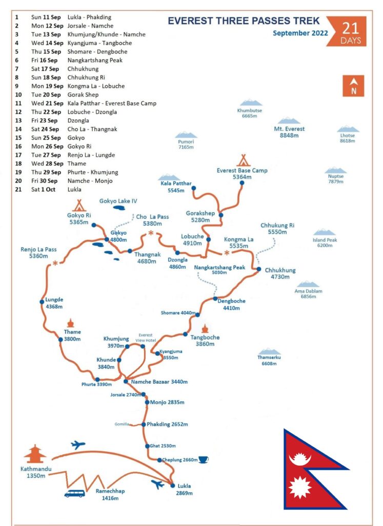
We flew to Lukla from Kathmandu then walked north to Namche Bazaar, the trading and tourist hub for the region.
We turned right and took the anti-clockwise circuit through the Everest mountains back to Namche.
The villages and sites listed include where we stayed, enjoyed a meal or reached a mountain peak.
The altitudes listed and some spellings of villages are approximates (I’ll explain in Post 2).
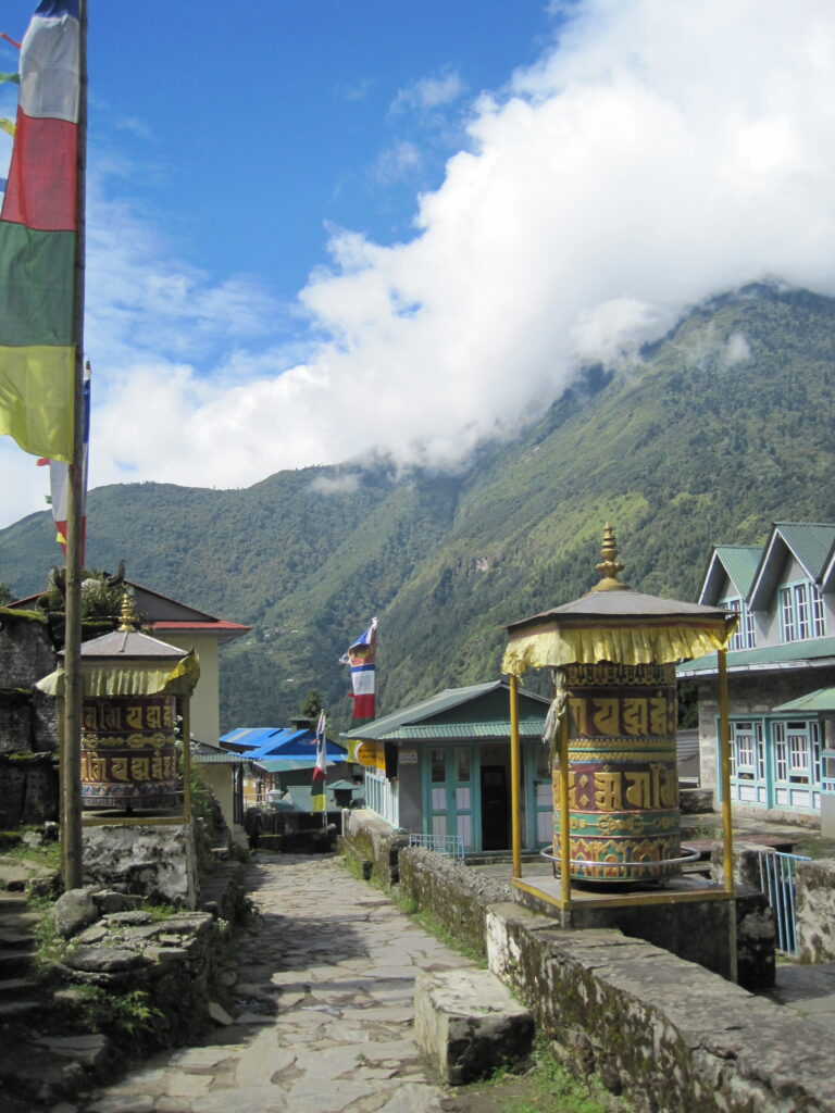
This area is known as the Khumbu Region and is home to the Sherpa people who migrated from Tibet in the 1500s.
The Sherpa people are Buddhist and have a strong connection to the environment, with many prayer wheels situated in water ways so that they turn continuously. The prayer wheels must be turned in a clockwise direction.
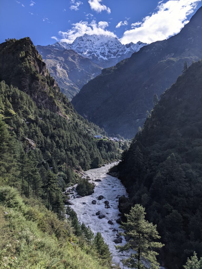
Thamserku is 6608m. We were walking at 2700m at this point.
Our path crisscrossed the river and followed the valley up.
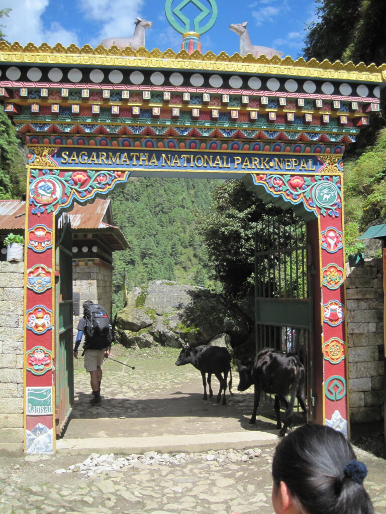
Sagarmatha is the Nepali name for Mount Everest, more on that in Post 3.
Yes, cows live in the National Park, as do yaks, mules, horses, the occasional chicken, and about 8,000 Nepalese people.
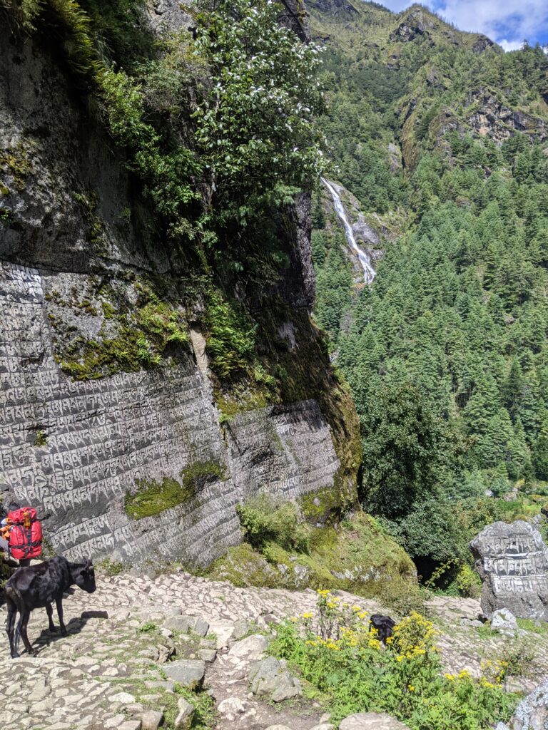
Trekking tourism is a HUGE part of the economy in this part of Nepal. The local people who work as guides and porters regularly finish one 9-20 day trek, only to start the next trek, on the same well-worn path, with a new group of tourists the next day.
Many villages are without their men for 3-6 months of the year across the trekking season.
The prayers are to protect the people while they are in the national park.
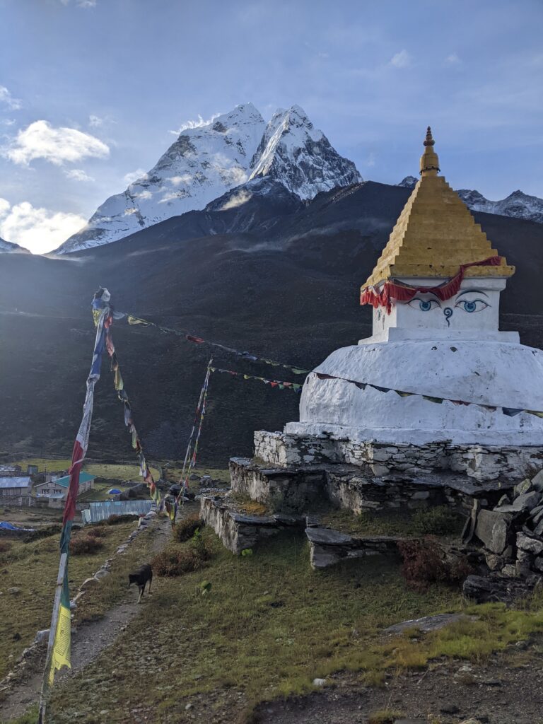
Stupas replicate the form of Buddha sitting cross-legged as he reached enlightenment. Stupas are thought to bring peace and balance to the world (human, animal & environment) around them.
Ama Dablam is the stunning mountain in the background – it follows you around the Everest region, peeking out from behind the clouds, looking over the valleys and rivers and villages – checking everyone is ok.
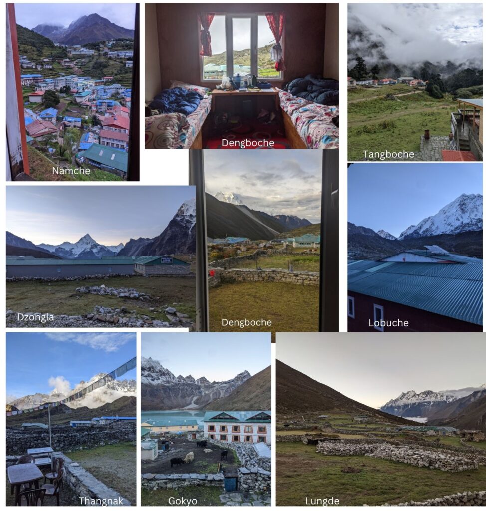
A collection of views from our bedrooms in the various Lodges where we stayed.
The top centre shows a typical room that hosts two long single beds with comfy foam mattresses.
That is Ama Dablam in the Dzongla photo.
